
Safety on Lion Mountain
Lion Mountain is not a dangerous mountain for a careful hiker in dry weather, and it is not a mountain to take lightly either. The risks are specific and worth naming plainly. The final steps onto the lion’s head are exposed, the basalt and clay are slippery when wet, there is no water or shade on the upper half, the trail is unmarked and dusk lasts about 20 minutes. This page covers each of those, the numbers to call, how to describe where you are and what to tell someone before you go.
Read the guide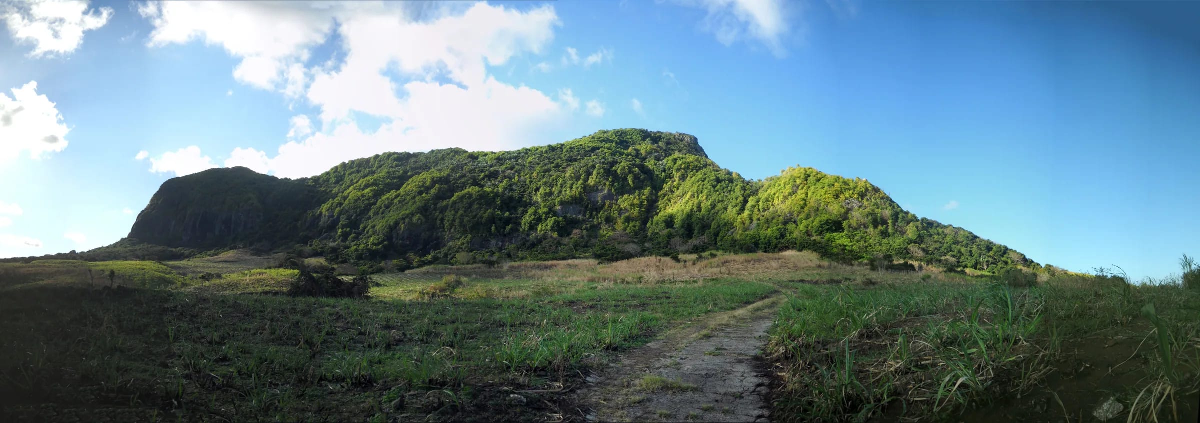
The lion’s head and the drops
The final section onto the summit block is the most exposed part of the mountain, and every source that describes the route says so. Inclined slabs of basalt and short rock steps lead onto the head with real drops on the bay side. The moves are short and nothing needs a rope, but a slip would be serious, and you have to reverse the same moves on the way down, facing outwards, with tired legs. Reviewers describe needing sure-footedness and a head for heights, and one route site simply tells people who are afraid of heights to avoid it.
Three habits make the head safer. Keep three points of contact on the slabs, test every hold before you trust it because sound basalt alternates with crumbly weathered rock, and sit down to lower yourself over the steps on the descent rather than stepping down facing out. Above all, decide before you start who in the group is going onto the head and who is waiting just below it, and make that decision in the car, not on the rock. Stopping just before the head costs almost nothing, because the view from the ridge is already most of the view.
Wet rock, clay and dry leaves
Lion Mountain is on the windward side of the island and its soil is a thin layer of clay over weathered basalt. The clay drains slowly and stays slippery for a long time after rain, which is the most repeated warning in recorded reviews, and the polished patches on the forest climb where thousands of boots have used the same holds are worst of all. In the dry season the carpet of fallen leaves on the steep sections does a similar job. Fog and rain can sit on the summit while the coast is in sunshine.
If it rained hard the day before, assume the forest climb is greasy and the slabs on the head are not acceptable, and plan for the ridge junction as your top. If cloud comes in while you are on the ridge, turn around while you can still see the line, because an unmarked ridge in fog is where people take the wrong spur. Shoes with a real sole matter more than any other item of kit on this mountain.
Heat, sun and no water
There is no water anywhere on the route and no shade on the upper half. From the ridge junction to the head you are on open rock that holds the heat, and from December to March the coast below records daytime highs of 30 °C with high humidity. Carry at least 1.5 litres of water per person, more in summer, and drink before you are thirsty. Wear a hat and sunscreen, start early so that the climb is done before the sun is high, and keep some water back for the descent, which is hotter than people expect because the slabs reflect the afternoon sun.
Know the signs of heat illness. A headache, dizziness, nausea, cramps or a sudden stop in sweating mean stop, get into whatever shade exists, drink and cool down before going anywhere. Going up is never the answer to any of those. The guided outings on this mountain exclude people with heart conditions, low fitness or reduced mobility, which is a sensible line for anyone to apply to their own group.
Timing and the short dusk
Most people need three to four hours for the round trip and the descent takes an hour or more by itself. Sunset falls between about 17:38 in June and 18:55 in January, and dusk this close to the equator lasts about 20 minutes before it is fully dark. There is no daylight saving to lengthen the evening. Plan to be off the head by mid afternoon at the latest, and treat anything later as a deliberate decision that needs a headlamp, a known route and company.
The dangerous combination is not the dark itself but the dark on the exposed slabs or in the cane. The slabs should be climbed and descended in daylight. The cane roads at the bottom are unmarked by day and far harder by night, when every junction looks the same. A headlamp, not a phone torch, belongs in the bag on every outing, because a sprained ankle at two in the afternoon becomes a descent in the dark soon enough.
An unmarked trail and how to stay on it
The route is unmarked. Through the sugar cane there is nothing at all, and the farm roads branch, bend and change with the harvest. Higher up there are informal marks, red paint on rock and yellow ribbons on branches, with long gaps between them, and the junctions on the ridge are not signed. People do not get seriously lost here, because the village and the coast road are downhill to the south-east and the mountain is small, but they do waste an hour in the cane, end up on the wrong ridge or find themselves descending steeper ground than they climbed.
Load a GPX track before you leave and check that it works offline. Note each junction on the way up so that the way down is familiar. If you lose the line, go back to the last point you were sure of rather than pushing on, and never descend steep unknown ground to shortcut the cane. Mosquitoes in the lower forest are mentioned in almost every review, so carry repellent. Do not go alone, and if you are new to Mauritian mountains or the weather is doubtful, a guide removes most of the navigation risk at a stroke.
Emergency numbers and describing where you are
In Mauritius the police emergency number is 999, and 112 also works from mobile phones. The SAMU ambulance service is 114. There is no dedicated mountain rescue line, so a call about an injured hiker goes to the police or SAMU, who decide what to send. Do not assume a quick response on a steep, unmarked ridge above a village. Do not assume a mobile signal on every part of the mountain; check it at the ridge junction while you still have options.
The caller’s job is to make the position unambiguous. The mountain has several names and the operator may not know the trail, so say all of the following slowly and be ready to repeat it.
- The mountain, in both languages. Lion Mountain, Montagne du Lion, above Vieux Grand Port, in the Grand Port district.
- The part of the route. The cane road above the village, the forest climb, the ridge junction, the eastern ridge near the flag viewpoint, or the summit block.
- Your coordinates, read from your phone as decimal degrees, digit by digit, including the minus sign for latitude. The summit is at about minus 20.3612, 57.7253.
- How many people, what has happened, whether the person is conscious and able to move, and how much water and daylight you have.
- Where you started and where your car is, so that a team knows which side of the mountain to approach from.
- Then stay where you are if it is safe, keep the phone warm and charged, make yourselves visible and keep the injured person shaded and drinking.
What to tell someone before you go
There is no attendant, hut, register or ticket office on the village side of Lion Mountain, so nobody knows you are on it unless you tell them. Leave a plan with someone who will notice if you are late, and agree what they should do if you have not called by a set time. The message can be a text; it should contain all of the following.
- The route. The spine from Vieux Grand Port, the eastern ridge loop, and which way round you intend to walk it.
- The time you are starting and the time you expect to be back at the car, with a margin of an hour.
- Where the car is parked and its registration, or the name of the taxi company and the pick-up time.
- Who is in the group and a phone number for at least two of you.
- The instruction to call 999 and describe the plan above if you have not made contact by an agreed time after your expected return.
- A note that you have checked the forecast for the south-east and know the turnaround rule for wet rock.
Incident records, closures and drones
Searches in English and French found no news report of a rescue, fall, fire or closure on Lion Mountain between 2023 and 2026. That is reassuring, and it is also not proof of anything, because this side of the mountain is unmanaged and incidents that end without a rescue are rarely reported. No authority issues closure notices for the village route, so there is nothing to check before you go other than the weather and any cyclone bulletin. The conditions hikers do report, consistently and across the period, are mosquitoes, mud, slippery leaves and fog on the summit.
Drones are a separate matter. The summit is about 9 km from the airport reference point, inside the innermost arc of the airport’s controlled airspace, and the Department of Civil Aviation does not authorise leisure drone flights in the vicinity of the airport or over areas where the public can gain access. New unmanned aircraft regulations have applied since 1 January 2025. Flying here without authorisation is an offence, not a grey area. Our drone page explains the rules and the penalties in detail.
Questions people ask
Is Lion Mountain dangerous?
Not for a careful, sure-footed hiker in dry weather who turns around when conditions are wrong. The real risks are the exposed slabs onto the head, slippery clay and rock after rain, heat with no water on the route and the unmarked cane roads in failing light. Each has a simple answer, and the simplest is to stop at the ridge junction when in doubt.
What is the emergency number in Mauritius?
Dial 999 for the police, or 112, which also works from mobiles. The SAMU ambulance service is on 114. There is no separate mountain rescue number. Say Lion Mountain or Montagne du Lion above Vieux Grand Port, describe which part of the route you are on and read your coordinates from your phone.
Is there mountain rescue on Lion Mountain?
There is no dedicated mountain rescue service in Mauritius. A call to 999 or 114 goes to the police or SAMU, who decide what to send. On a steep, unmarked ridge above a village that could take time, so a group should be able to shelter, shade and hydrate an injured person while help is organised. Never count on a quick response.
Can I hike Lion Mountain alone?
People do, including experienced visitors who saw nobody else all morning, but local guides and the French Lonely Planet both advise against it. Alone, a twisted ankle on the forest climb or a wrong turn in the cane becomes a real problem. If you go alone, leave a detailed plan with someone, carry a GPX track and stop below the head.
Have there been accidents on Lion Mountain?
No reports of a rescue, fall, fire or closure on Lion Mountain were found in English or French for 2023 to 2026. That is an honest absence of records, not evidence that nothing has happened, because the village route is unmanaged and minor incidents go unreported. The exposed head and wet rock remain the places to respect.
Can I fly a drone on Lion Mountain?
Not without authorisation from the Department of Civil Aviation. The summit is about 9 km from the airport, inside its controlled airspace, and leisure drones are not permitted in the vicinity of the airport or over areas open to the public. Regulations in force since January 2025 carry serious penalties. Read the drone page before packing one.
Pack for the mountain
A short, honest kit list for three to four hours on exposed tropical rock, from water and grip to the headlamp you hope not to use.