
The view from the summit of Lion Mountain
From the lion’s head the bay of Grand Port lies open below you, from Vieux Grand Port at your feet to Mahébourg across the water and the reef pass at Île de la Passe. The summit block itself is partly screened by trees, which surprises people who have climbed for the view, and the open rock of the eastern viewpoint under its flag is where most hikers end up taking their photographs.
Read the guide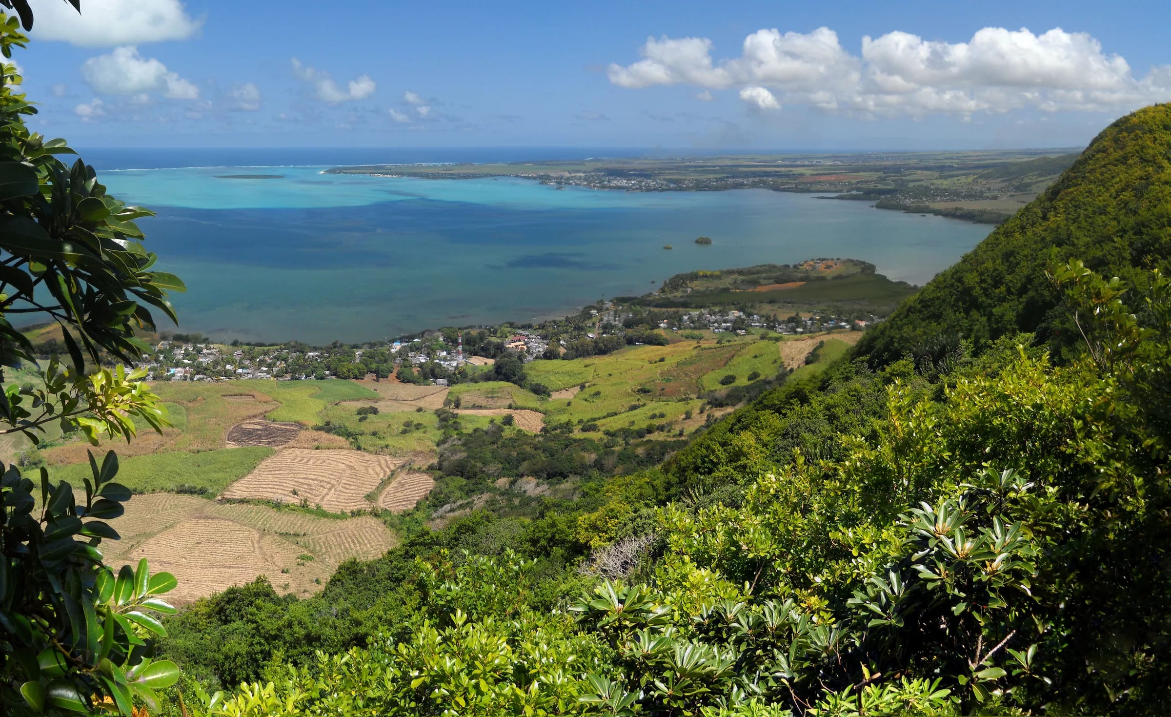
Two viewpoints, and they are not the same
People arrive on Lion Mountain expecting a single summit panorama and find something more complicated. The highest point, the lion’s head at about 480 m, is a rocky block with trees growing around and over it. You see the bay and the coast from the edge of the rock, but not in one sweep, and several reviewers over the years have written that the view from the summit is partly blocked while the eastern path has the best views. That matches what the terrain says. The head is the end of a long forested ridge, and the forest does not stop politely at the top.
The second viewpoint sits on the eastern ridge, the shorter spur that drops from the ridge junction towards the coast road east of the village. OpenStreetMap maps it as the Eastern Viewpoint and a popular hiking app lists it as the view of Mahébourg and the sea, rated five out of five by the hikers who logged it. Reviewers describe a Mauritian flag set over the rocks there, so you will know it when you reach it. It is lower than the head, the ground is open and the whole bay is laid out in front of you without a branch in the way.
There is a third, less visited spot above the west cliffs, reached from the ridge junction by a steep and slippery descent. The trail notes that describe it say the views are good.
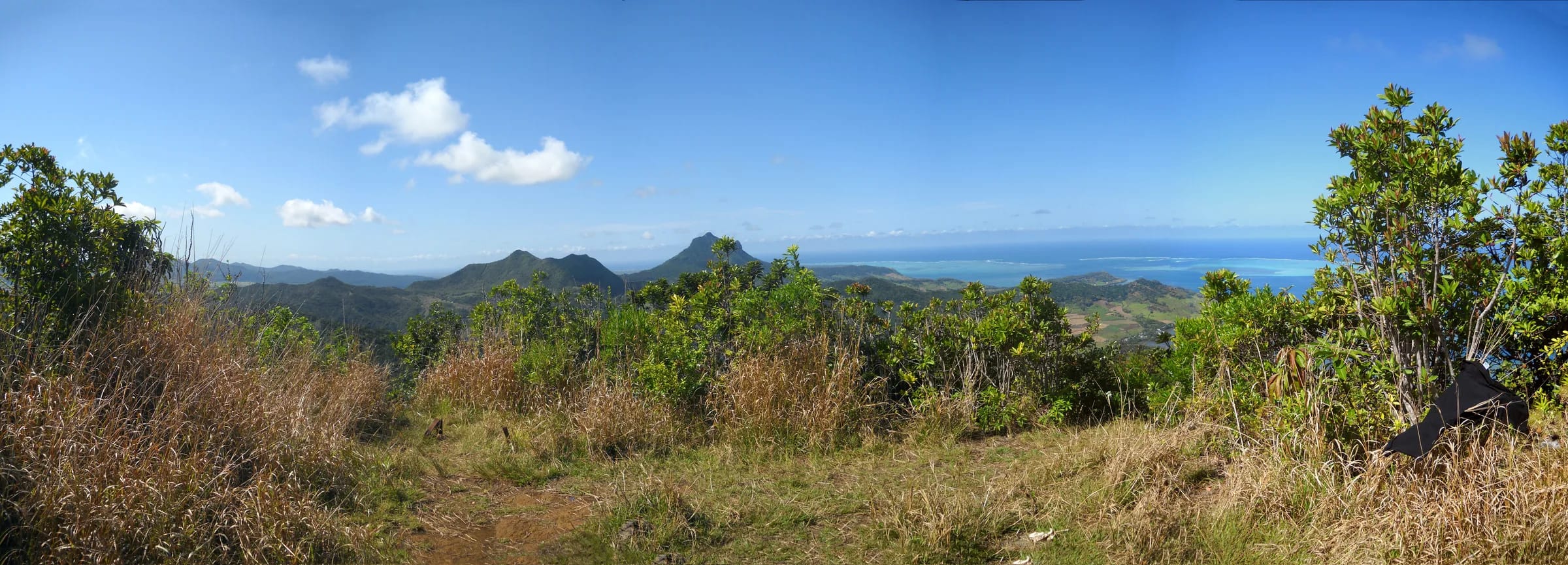
The bay of Grand Port below you
Look south and south-east and the lagoon fills the frame. Vieux Grand Port is directly below, a line of houses along the coast road with the museum grounds and the ruins of the Dutch fort among them. The reef runs across the mouth of the bay and the water changes colour where it meets the open ocean. This is the sheltered anchorage that Wybrand van Warwijck’s ships entered in September 1598 and the stretch of water where the Battle of Grand Port was fought in August 1810, so you are looking at the two oldest scenes in Mauritian history from the best seat in the house.
Mahébourg is about 6 km away to the south-south-west, a straight-line distance measured from the summit coordinates. On a clear morning you can make out the waterfront and the long low spread of the town. Just off its shore sits Mouchoir Rouge, the islet the size of a football pitch with the red-roofed house, less than 500 m from the Mahébourg shore and therefore roughly 6 km from where you stand. Further out in the lagoon, almost due south, is Île aux Aigrettes, the 26 to 27 ha coral islet about 850 m offshore that the Mauritian Wildlife Foundation has been restoring since the 1980s. It is about 6.6 km from the summit, close enough to see as a dark green dot ringed with pale sand.
To the south-east, where the reef opens, is Île de la Passe, the small island with the old French battery that guards the only safe channel into the lagoon. From its published coordinates it is roughly 6 km from the summit. Beyond Mahébourg and out of the main frame lies Blue Bay, roughly 9 km to the south and usually hidden by the Pointe d’Esny shore unless the air is very clear. North-east along the coast the shoreline runs past Bois des Amourettes towards the point of Pointe du Diable, about 6 km away.
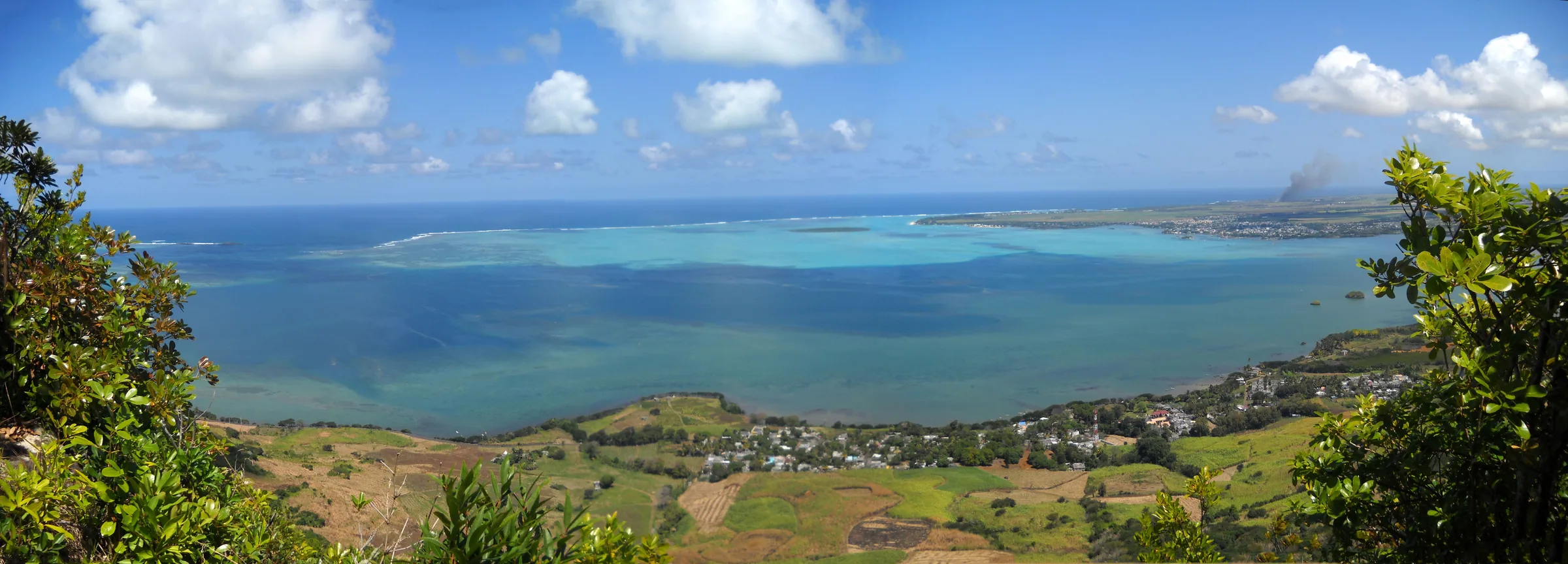
The runway, Ferney and the Bambous range inland
Turn your back on the sea and the island opens up in the other direction. The most obvious feature to the south-west is the runway of Sir Seewoosagur Ramgoolam International Airport at Plaine Magnien, a 3,040 m strip of grey in the cane about 8.8 km from the summit in a straight line. Aircraft on approach from the sea pass within easy sight of the ridge and you will often watch them come in below your eye level. It is also the reason drones are not allowed up here without authorisation, which has its own page on this site.
Immediately below the north-western flank is the Vallée de Ferney, a wide forested valley inside a 3,100 ha private estate where the Mauritian Wildlife Foundation and the estate have been clearing invasive plants and planting endemic trees. The valley reads as a darker, more varied green than the cane around it. Beyond it the Bambous range stretches away for about 12 km between Montagne Chat and Montagne Table à Perrot, the highest and longest of the three parallel chains on the east side of Mauritius. Its highest point, Montagne Bambou, reaches about 630 m and stands about 5 km away. Nearer peaks of the same range include Montagne Brisée at about 3 km and Piton Rouge and Mont Camizard at about 3.5 km.
The trade wind pushes cloud onto these mountains most afternoons, and the inland view is the first thing to go.
Landmarks by direction and distance
The distances below are straight lines from the summit coordinates. Where a figure is marked as rough it comes from the position of the landmark rather than a measured line, so treat it as a guide to scale rather than a survey.
| Landmark | Direction | Distance | Note |
|---|---|---|---|
| Vieux Grand Port | South, directly below | About 1.3 km | Trailhead village, Frederik Hendrik Museum and Dutch fort ruins |
| Mahébourg | South-south-west | About 6 km | Waterfront, market and the 1899 battle memorial at Pointe des Régates, about 5 km |
| Mouchoir Rouge | South-south-west | Roughly 6 km | Red-roofed islet less than 500 m off the Mahébourg shore |
| Île aux Aigrettes | South | About 6.6 km | 26 to 27 ha coral islet, nature reserve since 1965 |
| Île de la Passe | South-east | Roughly 6 km | Battery island at the reef pass, seized by the British in August 1810 |
| Blue Bay | South, beyond Mahébourg | Roughly 9 km | Marine park lagoon, often hidden by the Pointe d’Esny shore |
| Airport runway | South-west | About 9 km | 3,040 m runway at Plaine Magnien, aircraft on approach pass in view |
| Vallée de Ferney | North-west, directly below | Adjacent | Conservation valley and kestrel release site |
| Montagne Bambou | North to north-west | About 5 km | Highest point of the Bambous range, about 630 m |
| Pointe du Diable | North-east along the coast | About 6 km | French coastal battery beside the main road |
The best light for the bay and for the mountain
The bay is at its best early. The sun comes up over the ocean beyond the reef, the lagoon takes its colour as soon as the light is on it, and the air is at its cleanest before the day heats up and the trade wind brings cloud. Sunrise moves from about 05:22 in November to about 06:45 in July, so a start at first light is a different proposition in summer and winter, and the sunrise page on this site works through the timings month by month. For most people the practical version is simply to be on the ridge before 09:00. The climb is exposed and waterless, so an early start is sensible for reasons that have nothing to do with photography.
The mountain itself is a different subject. The classic view of the crouching lion is from Mahébourg, looking north-east across the water, and it is lit from the side and then from behind you in the afternoon. Late afternoon, when the sun has moved round to the west, is when the ridge shows its shape most clearly from the waterfront and from the coast road at Bois des Amourettes. If you want both, climb in the morning and photograph the lion from Mahébourg on the way home.
Sunset is early by European standards, between about 17:38 in June and 18:55 in January, and dusk near the equator lasts about twenty minutes. Do not plan to be on the lion’s head at sunset unless you have a torch, know the route and accept a descent on polished rock in the dark.
- For the bay and the islets, be at a viewpoint between first light and mid-morning.
- For the lion’s profile, photograph the mountain from the Mahébourg waterfront or Pointe des Régates in the last two hours of daylight.
- For aircraft against the view, the eastern viewpoint faces the approach path over the lagoon.
Haze, cloud and the trade wind
The south-east coast is the windward side of Mauritius. The trade wind arrives off the ocean, hits the eastern mountains and lifts, and the lifting makes cloud and rain. The Key Biodiversity Area factsheet for these mountains describes exactly that effect, with orographic rainfall from the south-east trades feeding dense forest, and the UK Met Office notes that the trade winds are strongest in July and August. In practice the lion’s head is in cloud more often than the coast below it, and a reviewer in July 2026 found fog and rain on the upper mountain while the village was dry.
Haze is a separate problem. In the hot months from December to April, when thunderstorms are most frequent, the air over the lagoon turns milky by late morning and the Bambous range flattens into a grey wall. The driest months at the airport station are September and October, with roughly 66 mm and 49 mm of rain, and that is when you have the best chance of a sharp horizon all the way to Île de la Passe and beyond.
If you reach the ridge and the head is wrapped in cloud, you have two sensible options. Wait on the ridge for a gap, because trade-wind cloud moves fast and often clears for a few minutes at a time. Or settle for the eastern viewpoint, which is lower and more often in the clear. Pressing on across wet rock for a view you cannot see is not one of the options worth taking.
Questions people ask
Can you see Mahébourg from Lion Mountain?
Yes. Mahébourg is about 6 km away in a straight line to the south-south-west and is clearly visible from both the summit block and the eastern viewpoint in clear weather. You can pick out the waterfront, the spread of the town and the red-roofed islet of Mouchoir Rouge just offshore. Early morning gives the sharpest view before haze builds over the lagoon.
Can you see the airport from the summit?
Yes. The runway at Plaine Magnien is about 8.8 km from the summit in a straight line and shows as a long grey strip in the cane to the south-west. Aircraft landing from the sea pass in full view of the ridge, often below the level of the summit. The same proximity is why flying a drone on the mountain requires authorisation from the civil aviation authority.
Is the view from the top blocked by trees?
Partly. Trees grow around the summit block, so the view from the lion’s head is in pieces rather than a single panorama, and several reviewers have said so. The eastern viewpoint on the ridge loop, marked by a Mauritian flag over the rocks, is open on all sides and is where most hikers take their photographs of the bay. Allow time for both if the weather holds.
Which viewpoint is best for photographs?
The eastern viewpoint, for the bay, Mahébourg and the islets, because nothing stands between you and the water. The summit block is worth reaching for the sense of height and the view back along the ridge, but it is not the better picture. For the mountain itself, the classic lion profile is photographed from the Mahébourg waterfront in the late afternoon, not from the mountain.
Can you see Île aux Aigrettes and Blue Bay?
Île aux Aigrettes, yes. It sits almost due south in the lagoon about 6.6 km from the summit and reads as a low, dark green islet ringed with sand. Blue Bay lies beyond Mahébourg, roughly 9 km to the south, and is usually hidden behind the Pointe d’Esny shoreline. You see the direction and the colour of the water rather than the beach itself.
How often is the summit in cloud?
Often enough to plan for it. The south-east trade wind lifts over these mountains and makes cloud, especially in the afternoon and in the windy months of July and August. Mornings are clearer, September and October are the driest months at the nearby airport station, and the lower eastern viewpoint is more often in the clear than the head. If the head is in cloud, wait on the ridge or settle for the eastern view.
Want the best pictures?
The photography page covers where the lion reads best, which light to wait for and the viewpoints along the ridge.