
The Lion Mountain hike from Vieux Grand Port
Lion Mountain is a short, steep climb with a serious finish. From the police station in Vieux Grand Port the mapped path runs 1.8 km up the lion’s back to the head, gaining about 400 m, and most people need three to four hours for the round trip. The cane roads at the bottom are unmarked, the forest climb needs hands, and the last rock steps onto the head are exposed. This page walks the route in order so that none of it comes as a surprise.
Read the guide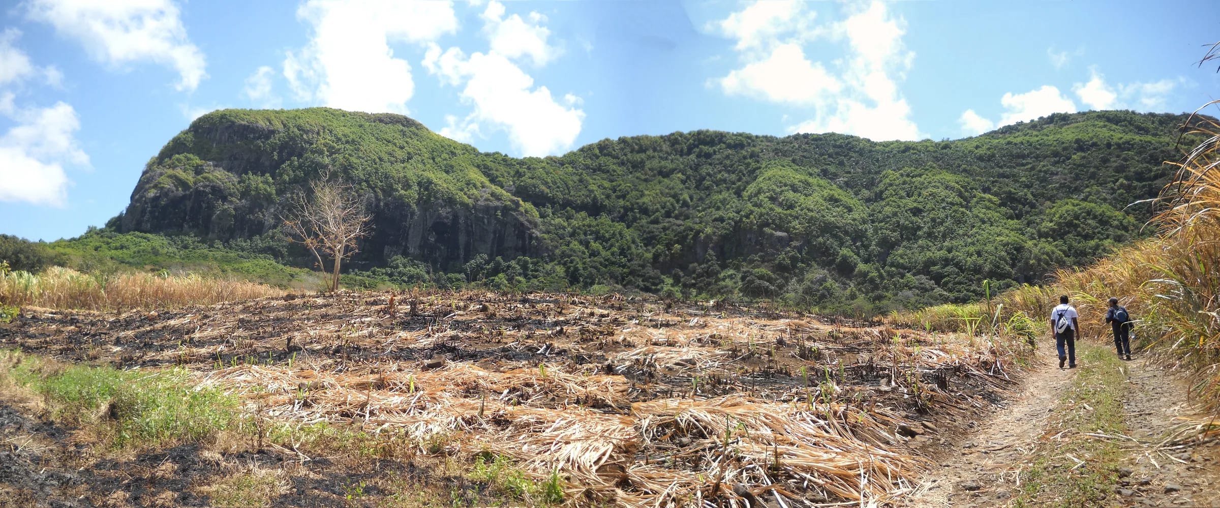
The route in one look
The route has three characters in sequence. The first is flat and easy, a cane road out of the village. The second is steep and shaded, a root-filled climb through secondary forest to the ridge. The third is open and rocky, the long ridge that hikers call the lion’s back and then the summit block they call the head. The map below shows the mapped spine and the eastern ridge loop with an elevation profile from a 30 m terrain model, which smooths the summit, so read it for shape rather than for the last metres.
There is no entrance fee, no permit and no opening time on this side of the mountain, and also no signboard, no car park and no maintained waymarking. The Vallée de Ferney on the northern side offers a car park and marked paths for a fee, covered at the end of this page.
Elevation profile from a 30 m terrain model, which smooths sharp summits. Distances follow the mapped path. Official summit height shown separately.
The route stage by stage
Distances come from the mapped geometry and times from recorded tracks and published guides. Treat both as ranges rather than targets.
The village and the police station
The walk starts on the B28 coast road at the northern end of Vieux Grand Port, by the police station, the one landmark every source agrees on. The Frederik Hendrik Museum is a few hundred metres away along the same road, and cars are left on the street. Behind the police station the way forks, one track heading north-west towards the main spine and another north-east towards the eastern ridge. You are only 25 to 40 m above the sea, so the whole height of the mountain is still ahead.
The cane road and Adrien Street
After about 100 m, Adrien Street leads off into the sugar cane. Follow the main cane road towards the middle of the mountain. It is wide, earthy, easy for the first 15 minutes or so, and completely unmarked, so keep the centre of the mountain ahead of you rather than trusting any one junction. Where the road curves to the right, the trail carries straight on. One account mentions a concrete bridge and two red arrows painted on a wall near the start; nobody else confirms them, so do not go looking. A large boulder marks the point where the real climb begins.
The forest climb to the ridge
The path narrows and steepens into a root-filled drainage line that climbs through secondary forest to the ridge. This is where hands first come out. There are rock steps, roots at knee height and, in the dry months, a carpet of leaves that one reviewer found as slippery as mud. Informal marks, red paint on rock and yellow ribbons on branches, appear with gaps between them. Several recorded reviews call this climb the hardest part of the day.
The ridge walk
At the ridge the path meets a junction. Right, towards the north, leads to the summit. Left leads to a viewpoint over the western cliffs by a steep and slippery descent; the map names a South-Eastern Viewpoint just off the spine here, probably the same place. From the junction the ridge is the lion’s back, drier and rockier, with no shade from here to the top. The view opens on both sides, the Vallée de Ferney and the Bambous range inland, the bay of Grand Port and the reef to the south-east. The eastern ridge path joins from the right about 340 m before the summit.
The lion’s head
The last section is the most exposed, and it is the one thing every source agrees on. Inclined slabs of basalt and short rock steps lead onto the head with drops on the bay side. You will use your hands, and you will come down the same rock afterwards. Anyone uneasy with drops can stop just before the head and lose very little, because the view from the ridge is already most of the view. The summit is recorded at 490 m on OpenStreetMap and about 480 m in most guides. One recent reviewer found the top partly screened by trees and preferred the flag viewpoint on the eastern ridge.
The descent and the eastern loop
The simplest descent is back down the spine, on ground you already know. The alternative is the eastern ridge, which leaves the spine at the junction below the head, descends a rocky crest past the Eastern Viewpoint with its Mauritian flag, drops to grass and turns west along the cane roads to close the loop in the village. On the mapped geometry the full loop is about 3.8 km; recorded GPS loops usually come in at 4.5 to 5 km because people wander to viewpoints and the cane roads add distance.
How far it is and how long it takes
Published figures disagree more than they should for such a small mountain, because people measure different things. The mapped spine from the village to the summit is 1.8 km one way, so a straightforward there-and-back is 3.6 km. Recorded GPS loops that add the eastern ridge and a viewpoint or two come in at 4.5 to 5 km, and the 8.4 km quoted by one hiking blog almost certainly describes the approach from the Ferney side.
Ascent figures run from about 400 m on the terrain model used for this guide to 480 m in most guides and up to 549 m on one recorded loop. The gap is partly the summit height itself, between 440 and 490 m depending on the source, and partly the ups and downs a loop adds. For planning, budget 400 to 480 m of climbing and three to four hours for the round trip, including time on top. Fit, experienced walkers manage it in two and a half to three hours; one hotel guide allows two and a half hours each way for a mixed group in heat.
| Source | Distance | Ascent | Time |
|---|---|---|---|
| Mapped spine, this guide | 1.8 km one way | About 400 m, terrain model | Not timed |
| GPS track on a French route site, August 2025 | 4.6 km loop | 477 m | 2 h 40 min |
| Popular route on a peak database | 4.5 km | 473 m | About 4 h |
| Mauritian turn-by-turn guide | 4.8 km loop | 549 m | 2 to 3 h |
| Hotel hiking guide | 5 km | 480 m | 2 to 3 h |
| Hiking blog, probably via Ferney | 8.4 km | Not given | 3 to 4 h |
When to start and what to carry
Start early. The second half of the route has no shade, the rock holds the heat and there is no water anywhere on the mountain. A 07:00 start puts you on the ridge before the sun is high and back at the car before the hottest part of the day, which is why guided outings leave at 07:00 or 08:30. From May to November an early start is pleasant rather than essential, and it still leaves the afternoon free for Mahébourg or the beach.
Carry at least 1.5 litres of water per person, more in the hot season, and wear shoes with real grip. Sunscreen and a hat matter on the ridge, and mosquito repellent comes up in almost every recorded review of the lower forest. Sunset falls between about 17:40 in June and 18:55 in January, and dusk this close to the equator lasts about 20 minutes, so a late start turns the cane roads into a navigation problem in the dark.
- Turn around at the ridge junction if the weather is closing in or the rock is wet. The view from there already repays the climb.
- Tell someone your plan and your expected return time. There is no attendant, hut or signing-in book on this side of the mountain.
- Leave nothing valuable on view in a parked car. Parking is on the street with nobody watching it.
Which way round the loop
Reviewers on the main route apps recommend walking the loop counter-clockwise, which here means taking the eastern ridge up and the main spine down, because the rocky eastern ridge is harder to descend than to climb. One turn-by-turn guide describes the opposite direction, descending the eastern crest to grass and walking west back to the cane road, so both directions are in use.
On a first visit, climb the spine, the better-trodden line, and decide at the junction below the summit whether the eastern ridge looks like a descent you want to make. If you have done it once and want the flag viewpoint in morning light over Mahébourg, go up the eastern ridge and come down the spine. Komoot users rate that viewpoint as the best outlook on the mountain, so the loop earns its extra effort either way.
The Ferney alternative and its fee
The Vallée de Ferney, on the northern side of the mountain, is a private conservation estate with marked trails, a reception, a car park and a restaurant. Its published routes are 5 km with 75 m of climb, 8 km with 178 m, 13 km with 530 m and 18 km with 970 m, graded from easy to difficult and technical. A Komoot loop recorded from the Ferney side measures 8.37 km with 260 m of climb, which matches the 8.4 km figure in one hiking blog. Whether a given Ferney route reaches the head itself is something to confirm at the reception.
Ferney charges for access. Its published adult rates in October 2026 are Rs 500 for visitors and Rs 250 for Mauritian residents, with lower rates for children. Activities run from 08:30 to 14:00, the reception closes at 17:00, and one recorded visit found the car park locked at 16:30 because it shuts at 16:00. The turn-off is signposted on the coast road about 2 km south of Vieux Grand Port. From the village the climb is free, steep, unmarked and quiet. From Ferney it is longer, gentler at first, marked, timed and paid for.
Questions people ask
How long does the Lion Mountain hike take?
Most hikers need three to four hours for the round trip from Vieux Grand Port, including time on the summit. Fit, experienced walkers do it in two and a half to three hours, and one guide allows two and a half hours each way for a slower group. The distance is short, 1.8 km each way on the mapped spine, but the forest climb and the rock on the head slow everyone down.
Is there an entrance fee for Lion Mountain?
Not from Vieux Grand Port. The village route is free, with no permit, ticket or opening hours. The Vallée de Ferney on the northern side charges for access to its marked trails, with a published adult rate of Rs 500 for visitors and Rs 250 for residents in October 2026, and its car park closes in the afternoon.
Do I need a guide for the Lion Mountain hike?
No guide or permit is required. Experienced hikers in dry weather manage without one, using a GPX track for the unmarked cane roads. A guide is sensible if you do not know the terrain, if the weather is doubtful or if anyone in the group is unsure about exposed rock. Guided outings usually meet in Vieux Grand Port at 07:00 or 08:30.
Which way round should I walk the Lion Mountain loop?
Reviewers on the main route apps advise counter-clockwise, climbing the eastern ridge and descending the main spine, because the eastern ridge is harder to come down than to go up. On a first visit many people simply climb the spine and return the same way, deciding at the junction below the head whether to add the eastern ridge.
Is there water or shade on the route?
There is no water anywhere on the mountain and no shade on the upper half. The forest climb to the ridge is shaded, but from the ridge junction to the head you are in the open on rock that holds the heat. Carry at least 1.5 litres of water per person, more between December and March, and start early.
Can I climb Lion Mountain from the Vallée de Ferney instead?
Yes, the valley on the northern side has marked trails and a car park, and recorded loops from that side run to about 8.4 km with far less steep climbing. You pay the valley’s access fee, keep to its hours and should confirm at the reception which route, if any, reaches the lion’s head. From the village the climb is free and much steeper.
Get the map and the GPX
The trail map page shows both mapped lines, the waypoints and the GPX files to load on your phone before you reach the cane.