
Lion Mountain questions and answers
Everything on this page is answered at greater length elsewhere on the site. This is the short version, grouped so that you can find the question you have, with the figures our sources give and the places where they disagree.
Read the guide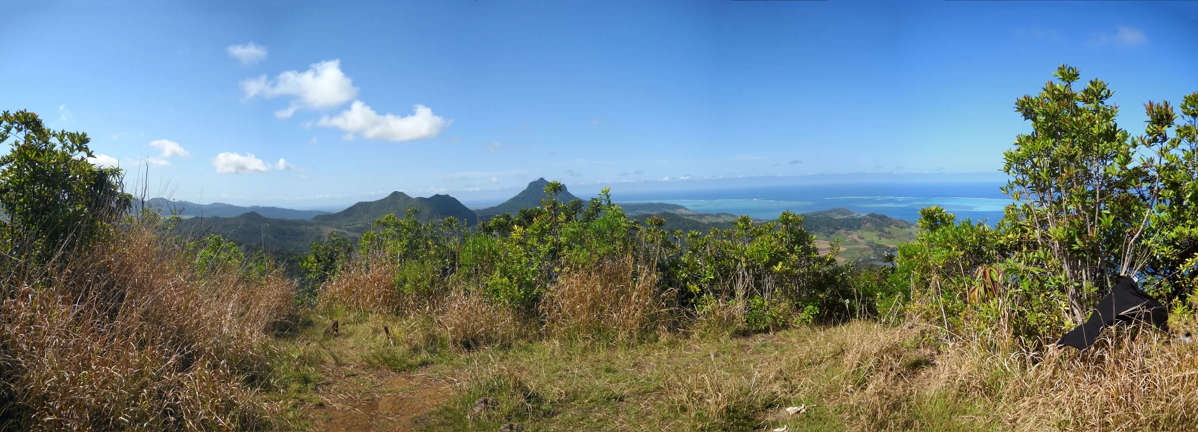
The mountain
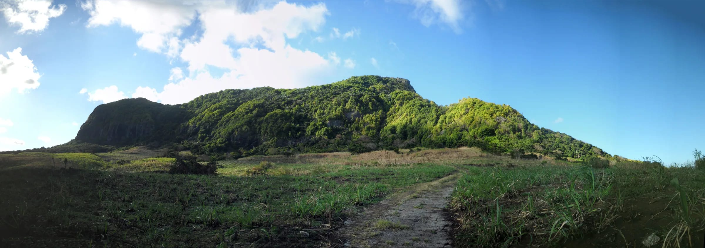
Lion Mountain, Montagne du Lion in French, is the ridge above Vieux Grand Port and the bay of Grand Port in the south-east of Mauritius. It belongs to the Bambous range, the highest of the three parallel chains on the east side of the island, and stands as its southern outlier between the Vallée de Ferney inland and the lagoon on the coast. From Mahébourg it reads as a lion lying down, with the long back rising from the south and the rocky head at the northern end.
The questions below deal with its height, which sources do not agree on, its name, its confusing namesakes elsewhere and what you see from the top. For the full account, read the mountain page and the summit view page.
The hike
The standard route starts in the village and climbs the lion’s back to the head. It is short, about 1.8 km each way on the mapped spine, and steep, with roughly 400 m of ascent from a start about 37 m above the sea. The lower part through cane is easy and unmarked, the climb to the ridge is steep and rooty, the ridge has rock steps that need hands and the final head is exposed. An eastern ridge of 1.7 km makes a loop and carries the flag viewpoint.
These answers cover time, difficulty, where the path starts, marking, guides, fees, the loop, sunrise starts and children. The hiking guide, the difficulty page and the trailhead page go deeper.
Getting there
Vieux Grand Port sits on the B28 coast road on the north-west shore of the bay. The airport at Plaine Magnien is about 13 km away by road, Mahébourg is a short drive round the bay, and Grand Baie is roughly an hour away by car with Flic en Flac about 40 minutes. There is no official car park at the trailhead and no published bus number for the coast road, although the road carries buses and has stops through the village.
The answers below cover the airport, buses, parking and the alternative start inside the Vallée de Ferney estate. The getting there page has the full picture by car, taxi and bus.
Safety
Lion Mountain is a serious little mountain. Its dangers are heat, wet clay and polished rock, the exposure of the head and the short tropical dusk, not altitude or distance. There is no water on the route, no marking you can rely on and no dedicated mountain rescue service in Mauritius. No rescue, fall, fire or closure on the mountain has been reported in searches covering 2023 to 2026, which is a gap in the record rather than proof that nothing happens.
These answers cover seasons, rain, emergency numbers, drones and dogs. The safety page and the weather page set the detail out properly, and the drone page explains the airport rules.
Around the bay
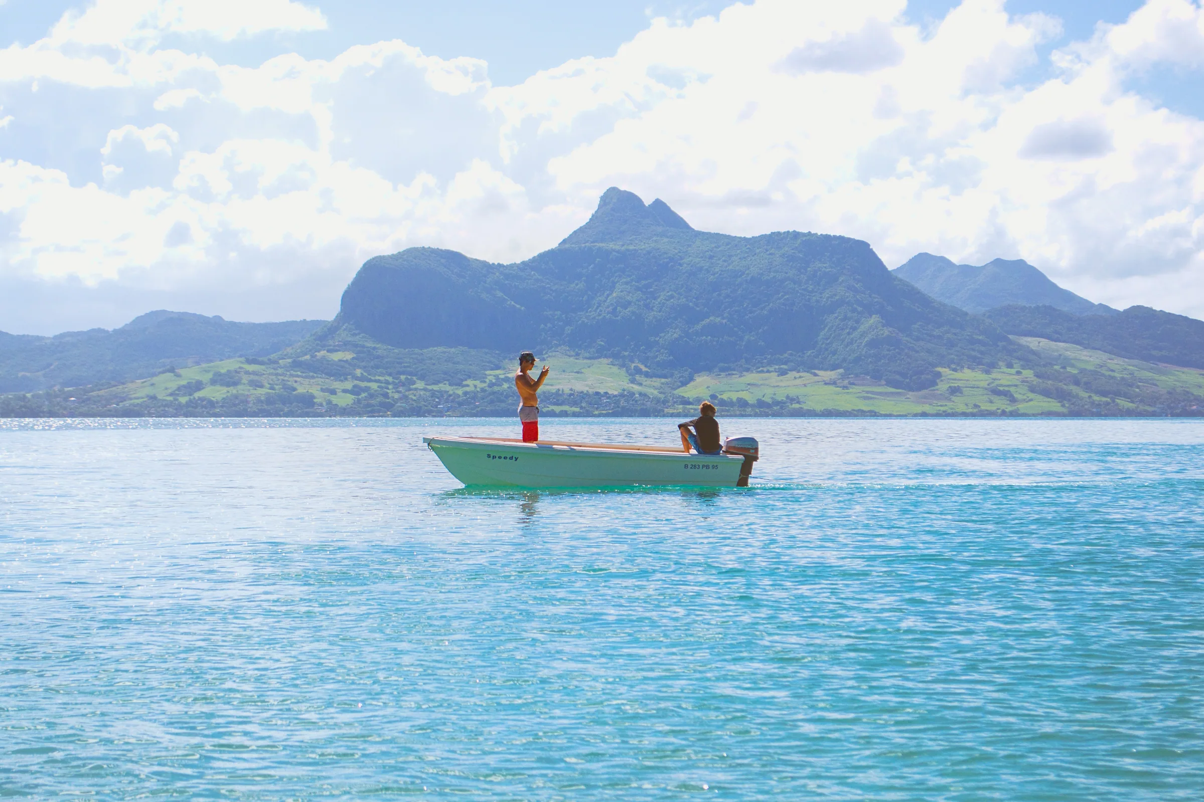
The mountain is the start of a day, not the whole of it. Mahébourg lies across the water with its market, waterfront and the 1899 battle memorial. Île aux Aigrettes, the restored coral islet in the lagoon, is reached by a short boat ride from Pointe Jérôme with the Mauritian Wildlife Foundation. Blue Bay Marine Park is the swim afterwards. Vallée de Ferney, on the inland side of the ridge, offers easier walks and the midday kestrel feeding.
The last group of answers covers the islet, the giant tortoises, the comparison people most often make with Le Morne Brabant and what else there is to do in Mahébourg. The day plan page strings it together.
Questions people ask
How tall is Lion Mountain?
About 480 m. Sources disagree. Wikipedia gives 440 m from a 2004 Mauritius Post stamp series, BirdLife, Lonely Planet and most Mauritian guides give 480 m, and peak databases and OpenStreetMap record 490 m. GPS tracks top out between 438 and 490 m. This guide uses about 480 m and notes the range of 440 to 490 m wherever it matters.
Why is it called Lion Mountain?
Because from Mahébourg and the coast road the ridge looks like a lion lying down, with the long back rising from the south and the head lifted at the northern end. The French name is Montagne du Lion, and both names are used on the island. Nobody has found a record of when the name was first given, and no Dutch-era name has survived.
Is Lion Mountain the same as Lion’s Head?
In Mauritius, yes. Geographic databases list Lion’s Head and Lion’s Head Mountain as alternative names for the same ridge above Vieux Grand Port. It is not the Lion’s Head above Cape Town, which is 669 m, nor the Lion Mountains of Sierra Leone, nor the Lion Mountain Trail in Montana. Search with Mauritius, Mahébourg or Vieux Grand Port to be sure.
What can you see from the top?
The whole bay of Grand Port with Île aux Aigrettes in the lagoon about 6.6 km away, Mahébourg at about 5.8 km, Blue Bay beyond it, the barrier reef and the runway of the airport at about 8.8 km, with cane and the Bambous range inland. Trees block part of the summit view, and hikers say the flag viewpoint on the eastern ridge is better.
How long does the Lion Mountain hike take?
Most hikers need 3 to 4 hours for the return trip from Vieux Grand Port, including time on the summit. Sources range from 2 to 3 hours for fast walkers to about 4 hours in Lonely Planet, and one source says 2.5 hours each way. The distance is short, about 1.8 km each way, but the rock steps slow everyone down.
How difficult is Lion Mountain?
Moderate to hard, and harder than its height suggests. The cane section is easy, the climb to the ridge is steep and rooty, and the ridge has rock steps where you use your hands, for roughly half the ascent by one account. It is scrambling in the hillwalker’s sense, with no ropes or fixed aids. The lion’s head is genuinely exposed. Komoot users rate it T3 to T3+, and anyone uneasy with drops can stop just before the head.
Where does the trail start?
In Vieux Grand Port, behind the police station on the coast road, a few hundred metres from the Frederik Hendrik Museum. After about 100 m the path takes a lane into the cane and follows the main cane road towards the middle of the mountain. There is no official car park, so cars are left on the village street near the police station or the shop.
Is the trail marked?
Not officially. The route through the cane is unmarked, and higher up the marking is informal, red paint and yellow ribbons left by hikers. Visorando calls it poorly marked, especially in the cane, and Explore Mauritius says the trail is hard to follow rather than physically hard. Download the GPX from this site before you go.
Do I need a guide for Lion Mountain?
No permit or guide is required and there is no fee from Vieux Grand Port. A guide is not necessary for an experienced hiker in dry weather, but is sensible if you do not know the terrain, the forecast is doubtful or you are new to exposed rock. Guided outings exist, typically starting at 07:00 or 08:30 from Vieux Grand Port.
Is there an entrance fee?
Not from Vieux Grand Port, where the trail is free with no gate and no hours. If you enter through the Vallée de Ferney estate on the inland side there is a fee, published at the time of writing as Rs 500 for visiting adults and Rs 250 for children, with lower resident rates, and the estate’s hours apply.
Can I do a loop, and where is the flag viewpoint?
Yes. An eastern ridge of about 1.7 km leaves the village slightly east of the main start, passes the eastern viewpoint, where a Mauritian flag stands over the rocks, and rejoins the main path below the summit. Hikers advise going up the eastern ridge and down the spine, because the eastern descent is the harder of the two.
Can I hike Lion Mountain at sunrise?
You can, but you climb the cane and the first rock steps in the dark, so you need a head torch, a known route and company. Sunrise ranges from about 05:22 in November to 06:45 in July. No operator runs a regular sunrise ascent, although the Ferney Trail race has climbed the mountain at dawn. Most people settle for an early start instead.
Is Lion Mountain suitable for children?
For confident, sure-footed children used to hiking, with an adult who will turn round before the head, yes. The cane and the lower ridge are fine, the rock steps need hands and the head has drops. Guided outings exclude low fitness and mobility impairment. The Vallée de Ferney next door has easier marked routes for younger families.
How do I get to Lion Mountain from the airport?
Vieux Grand Port is about 13 km from the airport by road, roughly 13 minutes by taxi. Mahébourg is about 6 km from the airport, and bus 9 runs between them. From Mahébourg, the coast road continues round the bay to Vieux Grand Port. The airport page on this site explains how to fit the hike around a flight.
Is there a bus to Vieux Grand Port?
Buses do run along the B28 coast road through Vieux Grand Port, with stops named Old Grand Port, Bambous Virieux and Grand Sable, but no route number for Mahébourg to Vieux Grand Port is published online. Ask at the Mahébourg bus station on the esplanade. Rural buses run from about 06:30 to 18:30, with nothing after 18:00 from Mahébourg.
Where do I park?
On the street in Vieux Grand Port, near the police station or the shop on the main road about 20 m from the start. There is no official car park at the trailhead. Keep valuables out of sight. If you start from the Vallée de Ferney instead, its car park has been reported locked after 16:00.
Can I start from Vallée de Ferney?
Yes, through the estate, with a fee and its hours, which run activities from 08:30 to 14:00. Hikers record loops from Ferney of about 8 km with roughly 260 m of climbing, and the estate’s longer routes reach 13 and 18 km. The estate does not publish which summits each route touches, so ask at reception.
When is the best time of year?
May to November, in dry weather. The south-east receives more rain than the west, the clay stays slippery long after showers and fog can sit on the ridge even in winter. Summer brings heat, thunderstorms and cyclone season, roughly November to April with the official warning window to mid May. Start early in any month.
What are the emergency numbers?
Police 999, and 112 also works. SAMU ambulance 114. Sources differ on the fire number, giving 115 or 995. There is no dedicated mountain rescue line in Mauritius, and the nearest road access is the village, so tell someone your plan, carry a charged phone and do not count on a quick rescue from the ridge.
Can I fly a drone on Lion Mountain?
Not without authorisation from the Department of Civil Aviation. The summit is about 8.8 km from the airport, inside the control zone, and the official guidance bars leisure drones near the airport and over any area the public can access. Regulations in force since 1 January 2025 carry fines of up to Rs 1,000,000 and up to 12 months in prison.
Can I bring a dog?
No rule has been published for the Vieux Grand Port trail. The Vallée de Ferney estate bans domestic pets. Given the recovering forest and the kestrels, and the exposed rock on the head where a dog on a lead is a hazard to both of you, this guide suggests leaving dogs at home.
How do I visit Île aux Aigrettes?
Through the Mauritian Wildlife Foundation, which runs guided eco-tours of 1.5 to 2 hours with a short boat crossing from Pointe Jérôme, the old sand jetty near the Preskil resort about 1 km from Mahébourg. Book in advance through the Foundation’s online partner. No current price was published when this page was written, so check before you go.
Are there giant tortoises on Île aux Aigrettes?
Yes. Aldabra giant tortoises were introduced as a stand-in for the extinct Mauritian tortoises, grazing and spreading seeds as the originals did. The islet also holds pink pigeons, Mauritius fodies, olive white-eyes, Telfair’s skinks and ornate day geckos, and the last patch of dry coastal ebony forest, on 26 to 27 ha about 850 m offshore.
Lion Mountain or Le Morne, which should I choose?
Different days. Le Morne is a managed World Heritage trail with gate hours, a Grade 1 lower path and an upper scramble that was closed for rockfall when this page was written. Lion Mountain is free, unmarked, steeper for its height, far quieter and finishes on an exposed head above a bay. The comparison page sets them side by side.
What else is there to do in Mahébourg?
The market, busiest on Mondays, the waterfront and the 1899 battle memorial at Pointe des Régates, the Biscuiterie Rault manioc biscuit factory across the Cavendish Bridge and boat trips on the lagoon. The National History Museum has been closed for renovation since 15 December 2025 with no reopening date announced. Blue Bay is a short drive south.
Walk the route stage by stage
The hiking guide covers the cane, the ridge and the head with honest notes and the mapped GPX.