
A history of Lion Mountain and the bay of Grand Port
The recorded history of Mauritius begins in the bay below Lion Mountain. Dutch ships anchored here in 1598, a Dutch fort stood at the foot of the ridge from 1638, the French governed the island from this shore before moving to Port Louis, and in 1810 the lagoon saw the only naval battle carved on the Arc de Triomphe. This page follows that story through to the museum and the hikers of today, and is honest about what the records do not say.
Read the guide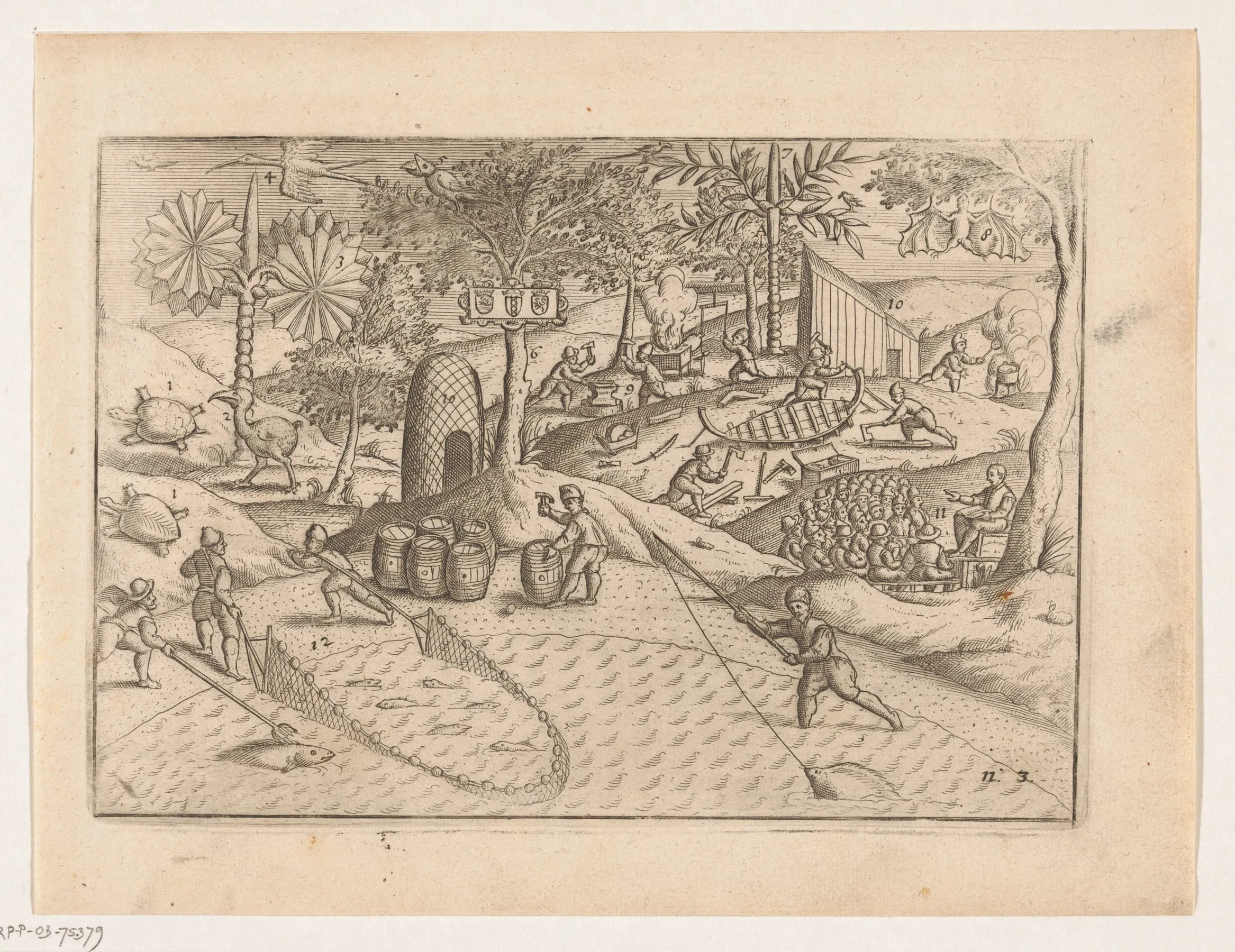
A forested shore before 1598
Mauritius had no permanent human population before the Dutch arrived. Vieux Grand Port, the village at the foot of Lion Mountain, is described as the island’s first human settlement, and the forest the first visitors found ran unbroken from the shore to the ridges. It was rich in ebony, which is the reason the island was worth occupying at all, and it was home to the dodo and to other birds that had never met a predator. The bay itself, sheltered by a coral reef with a single winding channel through it, gave ships a protected anchorage on the windward side of the island.
The Dutch century, 1598 to 1710
In September 1598 the ships of Wybrand van Warwijck, part of the second Dutch expedition to the East Indies under Jacob Cornelisz van Neck, entered the bay and named it Port de Warwick. Sources give the date as 17, 18 or 20 September, so this guide says on or around 20 September. The island was named after Maurits van Nassau, the stadtholder of the Dutch Republic, and the name outlasted every change of flag that followed.
For forty years the Dutch used the bay as a stopping place without settling. Then, in 1638, Cornelius Gooyer arrived with 25 men and built Fort Frederik Hendrik on the colluvial fan at the foot of Lion Mountain, naming it after Frederick Henry, Prince of Orange. The fort was a refreshment station for the Dutch East India Company. One Mauritian account dates the decision to build it to 1637 and describes a four-pointed star of wooden palisades and earthen ramparts. Under Adriaan van der Stel the colony turned to ebony. Large areas of forest were cut, and to cut them he brought 105 enslaved people from Madagascar, with more following in 1644 and 1645. Some escaped inland.
The colony never prospered. The first occupation ended in 1658. The Dutch came back in 1664, a cyclone wrecked the wooden fort in 1695, and in 1698 the commander Deodati built a stone lodge beside the ruins. Cyclones, droughts, pests and illness wore the settlers down, and when the Dutch finally left in 1710 they burned the settlement, leaving only the lodge standing. By then the dodo was gone, with the last confirmed sighting commonly given as 1662. The Dutch had also, probably around 1602, released the long-tailed macaques whose descendants still live on the mountain.
The French and the move to Port Louis, 1715 to 1806
France claimed the empty island in 1715 and settled it in 1722, and the first French government sat where the Dutch had been, on the shore below Lion Mountain. It did not stay. The administration moved to Port Louis, whose harbour on the north-west coast lies out of the trade wind, and Grand Port became a secondary post. From 1753 a French government complex with a lodge, a prison, a bakery and a smithy was built directly on the Dutch ruins, and the site served as a military post for the rest of the century.
The end of Grand Port as the centre of the south-east came in 1806, when the post moved across the bay to a new town named Mahébourg after the governor Mahé de La Bourdonnais. Mahébourg grew and the old settlement did not. It took the name Vieux Grand Port, Old Grand Port, and the fort site slipped under grass and cane. One French house of this period, the Château Gheude of about 1772 on the La Chaux river in Mahébourg, would find its place in history four years after the move.
The week of the battle, August 1810
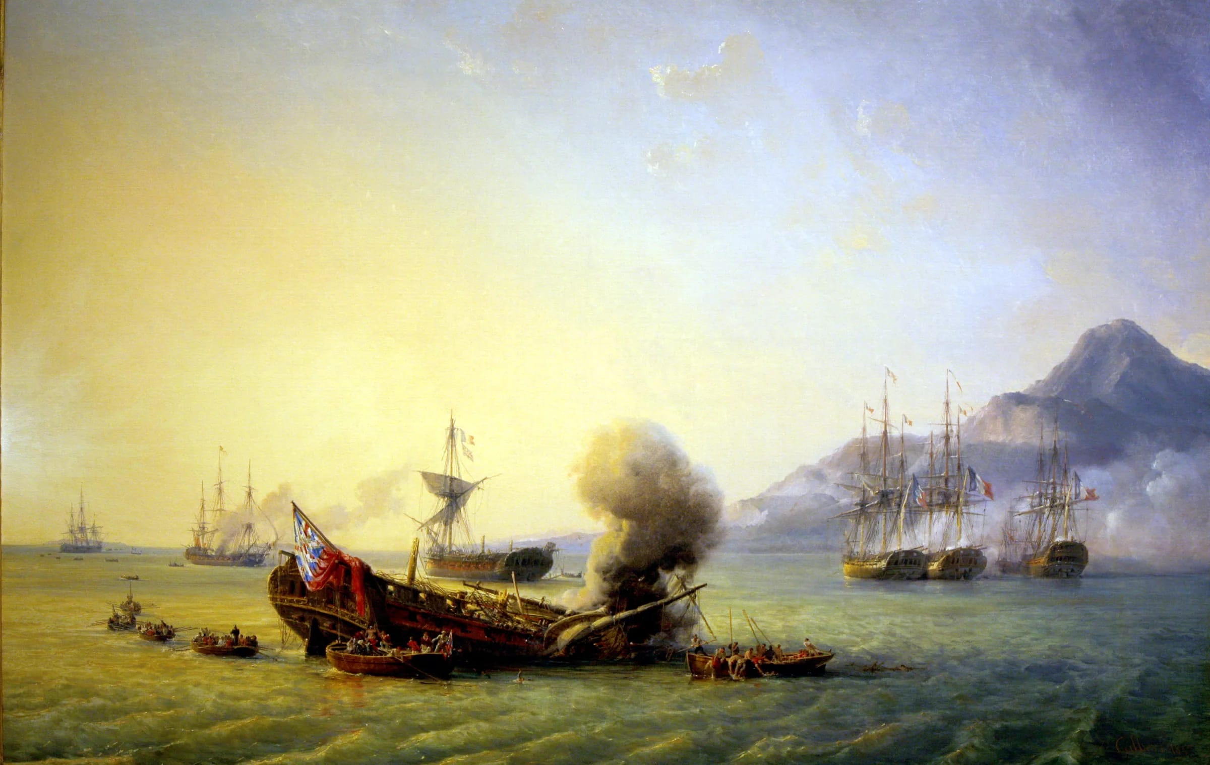
Between 20 and 27 August 1810 the bay became a battlefield. A British squadron under Captain Samuel Pym had seized the battery on Île de la Passe at the reef pass and tried to trap a French squadron under Guy-Victor Duperré inside the lagoon. The French moved the channel buoys, two British frigates ran onto the coral and were burned by their own crews, a third surrendered after a close-range battering and the fourth gave up when Commodore Hamelin arrived with reinforcements from Port Louis. Four frigates were lost. It was the most significant defeat the Royal Navy suffered in the Napoleonic Wars, and it is the only naval battle whose name is carved on the Arc de Triomphe in Paris.
The battle page on this site tells the week in detail, with the ships, the reef, the wounds of both commanders and the tradition that Duperré and Nesbit Willoughby were nursed in the same house in Mahébourg. From the ridge of Lion Mountain you look straight down on the water where it happened.
British rule and the memorial of 1899
The victory changed little for long. A British invasion force landed at the end of November 1810 and Isle de France was captured on 3 December 1810, barely three months after Grand Port. The Treaty of Paris of 30 May 1814 confirmed British possession and the island became Mauritius again in name. Slavery was abolished on 1 February 1835, and in the decades that followed indentured labourers arrived from India through the Aapravasi Ghat in Port Louis and reshaped the island’s population.
Grand Port was remembered under the British as well. On 30 December 1899 a monument to the battle was erected at Grand Port, the obelisk that still stands at Pointe des Régates on the Mahébourg waterfront, looking across the water at the lion. On 15 September 1950 the Gheude house, where the wounded commanders are said to have been treated, opened as a museum, and it is now the National History Museum. Mauritius became independent on 12 March 1968.
Uncovering the fort, 1997 to 2005
The Dutch fort came back into view at the end of the twentieth century. Archaeologists from Rutgers University in the United States and the University of Amsterdam excavated the site and found the Dutch layers about 50 cm below the French buildings of the 1750s, with the wall of the stone lodge of 1698 as the key find. The dates of the digging are given differently by different sources. The Mauritius Museums Council says work has gone on since 1997, while a Mauritian newspaper account counts five seasons, in 1999 and 2000 and from 2003 to 2005.
In 1998, for the 400th anniversary of the landing, the site was rehabilitated and landscaped and inaugurated by Prince Maurits van Oranje-Nassau, a namesake of the prince the island was named after. The Frederik Hendrik Museum opened on 27 May 1999 with an exhibition donated by the Dutch government. One encyclopaedic article gives 2010 for the museum’s opening, but the Museums Council, which runs it, gives 1999, and this guide follows the Council. Entry is free and the ruins sit in the museum grounds a few hundred metres from where the Lion Mountain trail leaves the village.
The mountain in Mauritian life today
For most Mauritians Lion Mountain is a shape rather than a site. It is the view across the water from the Monday market in Mahébourg, the ridge that fills the windscreen on the coast road to Bois des Amourettes, and the mountain that passengers see from the left-hand windows of an aircraft landing from the sea. Mauritius Post put it on a stamp in its Mountains of Mauritius series in 2004. Vieux Grand Port at its foot had about 3,000 people at the 2011 census.
For hikers it is a serious half-day, and the Ferney Trail race that starts in the valley on the far side has in past editions sent its longest courses over the summit at sunrise. The Vallée de Ferney itself, where a planned highway was scrapped after rare plants were found, became a conservation zone in the mid 2000s, and the kestrels released there from 1987 onwards have been seen over the mountain. A hotel magazine once cast the squat lion as a powerless guardian who watched the ebony forest fall and the dodo vanish. That is a writer’s image rather than folklore, but it is hard to stand on the head and not feel some of it.
The dates at a glance, and what the records do not say
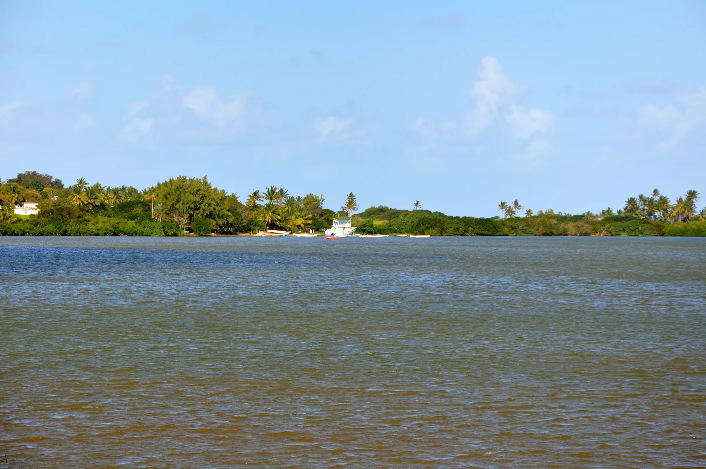
Two things visitors ask about cannot be answered from the sources. No document found for this guide gives a Dutch name for the mountain, even though the Dutch lived at its foot for the better part of a century, and no old map or record shows when the name Montagne du Lion first appears. The lion is simply there in the French and British sources, as if it had always been called that. Where this page gives a single date for an event that sources disagree on, the disagreement is noted in the text above.
| Year | Event |
|---|---|
| 1598 | Van Warwijck’s ships enter the bay on or around 20 September and the island is named after Maurits of Nassau |
| 1638 | Cornelius Gooyer founds the settlement with 25 men and builds Fort Frederik Hendrik |
| 1658 | The first Dutch occupation ends |
| 1664 to 1710 | Second occupation; a cyclone wrecks the fort in 1695, a stone lodge is built in 1698 and the Dutch burn the site on leaving in 1710 |
| 1715 | France claims the island |
| 1722 | French settlement; the government later moves to Port Louis |
| 1753 | French government complex built on the Dutch ruins |
| 1806 | The post moves to the new town of Mahébourg |
| 1810 | Battle of Grand Port, 20 to 27 August; the British capture the island on 3 December |
| 1814 | Treaty of Paris confirms British possession, 30 May |
| 1835 | Slavery abolished, 1 February |
| 1899 | Battle memorial erected at Grand Port, 30 December |
| 1950 | National History Museum opens in the Gheude house in Mahébourg, 15 September |
| 1968 | Independence, 12 March |
| 1998 to 1999 | Fort site rehabilitated for the 400th anniversary; the Frederik Hendrik Museum opens on 27 May 1999 |
Questions people ask
Who were the first people to land in Mauritius?
The first recorded landing and the first settlement were Dutch. Wybrand van Warwijck’s ships entered the bay of Grand Port in September 1598, on or around the 20th, and named the island after Maurits van Nassau. Vieux Grand Port at the foot of Lion Mountain is described as the island’s first human settlement, and the Dutch built Fort Frederik Hendrik there in 1638.
Why is the village called Vieux Grand Port?
Because it was the original Grand Port. The Dutch called the bay Port de Warwick, the French called the settlement Grand Port, and when the French military post moved across the bay to the new town of Mahébourg in 1806 the old shore became Vieux Grand Port, meaning Old Grand Port. The official address of the museum there is still Royal Road, Old Grand Port.
Why was Fort Frederik Hendrik built?
As a refreshment station for the Dutch East India Company, where ships on the long passage to and from the East Indies could take on water and food, and as the base for cutting the island’s ebony. Cornelius Gooyer built it in 1638 with 25 men and named it after Frederick Henry, Prince of Orange. It stood on the colluvial fan at the foot of Lion Mountain, a few metres above the shore.
Why did the Dutch leave Mauritius?
The colony never paid its way. Cyclones, droughts, pests and illness wore it down; the first occupation ended in 1658, the Dutch returned in 1664, a cyclone destroyed the wooden fort in 1695, and in 1710 they gave up for good, burning the settlement and leaving only the stone lodge of 1698. By then the ebony was largely cut and the dodo had gone, with the last confirmed sighting commonly given as 1662.
What did the Dutch call Lion Mountain?
Nobody knows. No source consulted for this guide records a Dutch name for the mountain, even though the Dutch lived directly beneath it for most of a century, and no old map or document shows when the French name Montagne du Lion was first used. The honest answer is that the shape named itself at some point and the record of that moment has not survived.
Why did the French move the capital from Grand Port to Port Louis?
The sources used here simply record that the government settled at Grand Port in 1722 and then moved to Port Louis. The usual explanation is that Port Louis has a deep harbour on the north-west coast, out of the south-east trade wind, while Grand Port is a reef-bound bay facing the weather. Grand Port stayed a military post until 1806, when it moved to Mahébourg.
What is there to see of this history at the foot of the mountain?
The excavated ruins of Fort Frederik Hendrik and the French buildings on top of them sit in the grounds of the free Frederik Hendrik Museum on the coast road in Vieux Grand Port, a few hundred metres from the trailhead. The Dutch First Landing memorial stands nearby. Across the bay in Mahébourg are the 1899 battle memorial at Pointe des Régates and the National History Museum, closed for renovation since December 2025.
Start where the story starts
The Dutch landing page follows Van Warwijck into the bay in 1598 and down to the museum garden where the fort was dug out of the grass.