
Lion Mountain trailhead and parking in Vieux Grand Port
The Lion Mountain trail starts in the village of Vieux Grand Port on the south-east coast, behind the police station on the B28 coast road, a few hundred metres from the Frederik Hendrik Museum. There is no car park, no signboard and no ticket office. You park on the street, walk about 100 m to Adrien Street and follow it into the sugar cane. This page gives you the landmarks, the GPS points and the things you should not expect to find.
Read the guide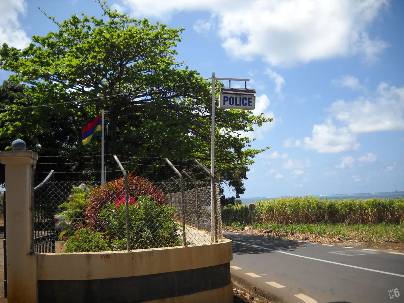
Finding the start on the coast road
Vieux Grand Port is a strip of a village along the B28, the coast road that runs north from Mahébourg along the bay of Grand Port towards Bambous Virieux and Grand Sable. Coming from Mahébourg or the airport you pass the signposted turn-off for the Vallée de Ferney about 2 km before the village, then the Frederik Hendrik Museum beside the road, with the Dutch First Landing memorial close by at the foot of the mountain. The police station is at the northern end of the village, and it is the one landmark that every description of the hike agrees on.
The mountain itself is the obvious guide. From anywhere on the coast road the lion’s back rises straight out of the cane behind the houses, with the head at the northern end. The trail climbs the long ridge from its southern end, which is why the start is in the village rather than below the head. If you are standing by the police station with the sea behind you and the mountain ahead, you are in the right place.
The first metres into the cane
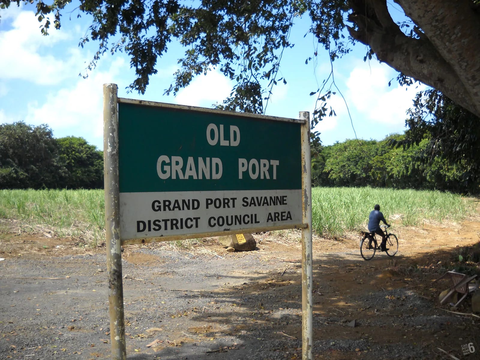
Behind the police station the way forks. The track to the left heads north-west towards the main spine of the mountain, the one this guide maps as the standard route. The track to the right heads north-east towards the eastern ridge, which is the other half of the loop. For the standard route, follow the road for about 100 m and take Adrien Street into the sugar cane. Then stay on the main cane road and keep the centre of the mountain ahead of you. Where the road curves to the right, the path goes straight on, and a large boulder marks the point where the climb proper begins.
One blog mentions a concrete bridge and two red arrows painted on a wall near the start. No other account confirms them, cane-road furniture changes, and paint fades, so look out for them but do not turn back if you cannot find them. Nothing about the first kilometre is signed, and a GPX track on your phone is worth more here than any landmark.
GPS references worth saving
Published starting points for Lion Mountain are a few hundred metres apart, because different people begin from different corners of the village. The spread is not an error. It reflects a village start with no single official trailhead. Save two or three of these and you will not go far wrong.
| Point | Latitude, longitude | Note |
|---|---|---|
| Start used by a Mauritian hiking guide | -20.37485, 57.72223 | Falls almost on the museum, so treat it as the general start area by the coast road |
| Start of a recorded French GPS track | -20.37392, 57.72716 | Named Lion Mountain Road on that site, at about 23 m above the sea |
| Start of the mapped spine on this guide | -20.372723, 57.725837 | About 37 m above the sea, near the bus stops and the museum |
| Start of the mapped eastern ridge | -20.372332, 57.727046 | Leaves the village slightly to the east |
| Frederik Hendrik Museum | -20.37496, 57.72206 | The nearest public building to the start |
| Summit | -20.3611505, 57.7252789 | OpenStreetMap peak node, recorded at 490 m |
Where to leave the car
There is no car park at the village start. OpenStreetMap shows parking areas on the Ferney side of the mountain, several kilometres away by road, but nothing in Vieux Grand Port itself. Hikers park on the street near the police station, and one reviewer found it easy to leave a car by the small shop about 20 m along the main road. Park tight to the verge on the coast road or on a side street, not on the cane road, which carries farm vehicles during the harvest.
Treat it as ordinary village street parking. Nobody is watching the car, so leave nothing visible inside, lock it and take your valuables up the mountain with you. If you are arriving by taxi, agree a pick-up time with a margin, because there is no café or shelter at the start to wait in, and the museum is the only public building within easy reach during its opening hours.
Arriving by bus
The B28 through Vieux Grand Port has bus stops every few hundred metres, and the ones nearest the start are around the museum and the police station. Published stop names along this coast include Old Grand Port, Bambous Virieux and Grand Sable. The route information available online does not name a route number for the Mahébourg to Vieux Grand Port stretch, so ask at the Mahébourg bus station on the esplanade for a bus towards Bambous Virieux or Grand Sable and get off at Old Grand Port by the police station.
Rural services in Mauritius generally run from about 06:30 to 18:30, with departures from Mahébourg roughly every half hour and nothing after 18:00, so an early start by bus is possible but a late return is not. From the airport, bus route 9 reaches Mahébourg in about ten minutes, and route 198 links Port Louis with Mahébourg. Our getting there page covers connections from the rest of the island.
The Frederik Hendrik Museum next door
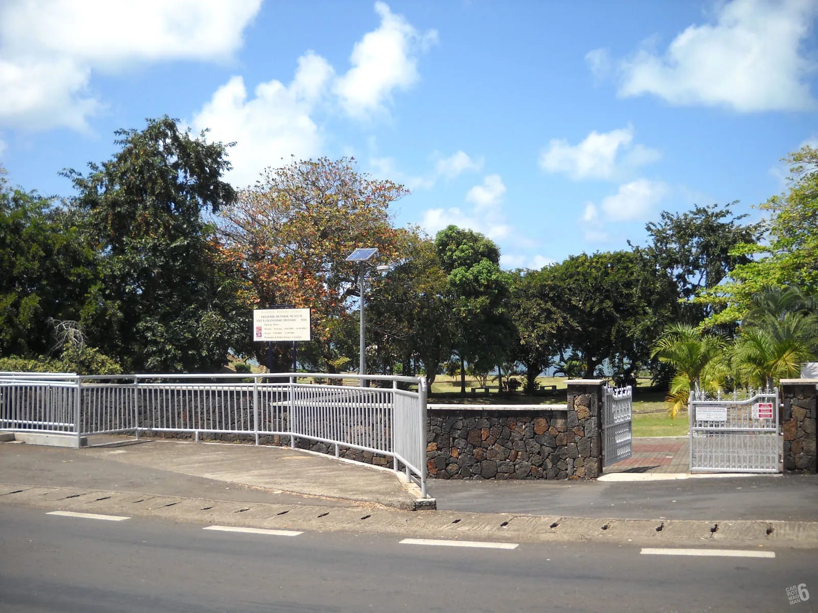
A few hundred metres from the start, on Royal Road in Old Grand Port, the Frederik Hendrik Museum stands on the site of the Dutch fort of 1638 and the French buildings that followed it. The excavated foundations are in the grounds, the site was landscaped for the 400th anniversary of the Dutch landing in 1998, and admission is free. The published hours are 09:00 to 16:00 on Monday, Tuesday, Thursday, Friday and Saturday, 11:00 to 16:00 on Wednesday and 09:00 to 12:00 on Sunday, closed on public holidays. Check before relying on them.
For a hiker it serves two purposes. It is the landmark that confirms you are in the right village, and it is the natural place to spend half an hour after the climb, when your legs want flat ground and your head wants to know what it has been looking at. The Dutch First Landing memorial is beside the same stretch of road.
What not to rely on
Several things that visitors expect at a trailhead are not here, and some landmarks repeated online are unconfirmed. Plan around the list below rather than around them.
- There is no official car park, no attendant and no opening hours. You park on the street.
- No signboard or trail marker on the B28 has been confirmed by any source. Descriptions that mention a church or a trail sign as the landmark are unsourced.
- The concrete bridge and the two red arrows come from a single account. They may be there, they may have faded.
- The cane roads are working farm roads. Their layout and surface change with the harvest, so a line that was obvious in one review may be overgrown or re-cut in another season.
- There is no water, no toilet and no shelter at the start. The museum is the nearest public building, during its hours only.
- The start is not the Vallée de Ferney. Ferney has a car park, a reception and a fee, and its turn-off is about 2 km south along the coast road. The two starts are not interchangeable.
Questions people ask
Where does the Lion Mountain trail start?
In Vieux Grand Port, on the south-east coast of Mauritius, behind the police station at the northern end of the village on the B28 coast road. After about 100 m, Adrien Street leads into the sugar cane and the cane road heads for the middle of the mountain. The Frederik Hendrik Museum is a few hundred metres away on the same road.
Is there parking at the Lion Mountain trailhead?
No car park. Hikers leave cars on the street in the village, near the police station or by the small shop on the main road. Park clear of the cane road and leave nothing on view inside. OpenStreetMap shows parking areas on the Ferney side of the mountain, but those serve a different start several kilometres away.
Can I get to the trailhead by bus?
Yes. Buses along the B28 coast road stop in Vieux Grand Port, and the stops nearest the start are around the museum and the police station. No route number is published for the Mahébourg to Vieux Grand Port stretch, so ask at the Mahébourg bus station for a bus towards Bambous Virieux or Grand Sable. Services run roughly 06:30 to 18:30, with nothing late.
Is the Lion Mountain trail signposted?
No. No signboard on the coast road has been confirmed, the cane roads are unmarked and the waymarks higher up are informal red paint and yellow ribbons with gaps between them. The police station is the reliable landmark, the mountain itself shows you the direction and a GPX track on your phone does the rest.
How far is the trailhead from the airport?
About 13.4 km by road, roughly 13 minutes by car or taxi, heading north-east through Mahébourg and up the coast road. The summit is about 8.8 km from the airport in a straight line, which is close enough that aircraft on approach pass within sight of the ridge.
Is the Vieux Grand Port start the same as the Ferney entrance?
No. Vieux Grand Port is a free, unmanaged village start on the coast road. The Vallée de Ferney is a private estate on the northern side with its own signposted turn-off about 2 km south along the coast, a reception, a car park, published hours and an access fee. Choose one and plan around it.
Now walk the route
The hiking guide takes you from the police station to the lion’s head stage by stage, with the turnaround points marked.