
How hard is Lion Mountain?
Lion Mountain is graded anywhere from not physically hard to very difficult, depending on who is writing, and both are true of different parts of the route. The cane road is a stroll, the forest climb is steep and needs hands, and the final steps onto the lion’s head are genuinely exposed. This page grades each element separately so that you can judge it for yourself rather than for an average hiker who does not exist.
Read the guide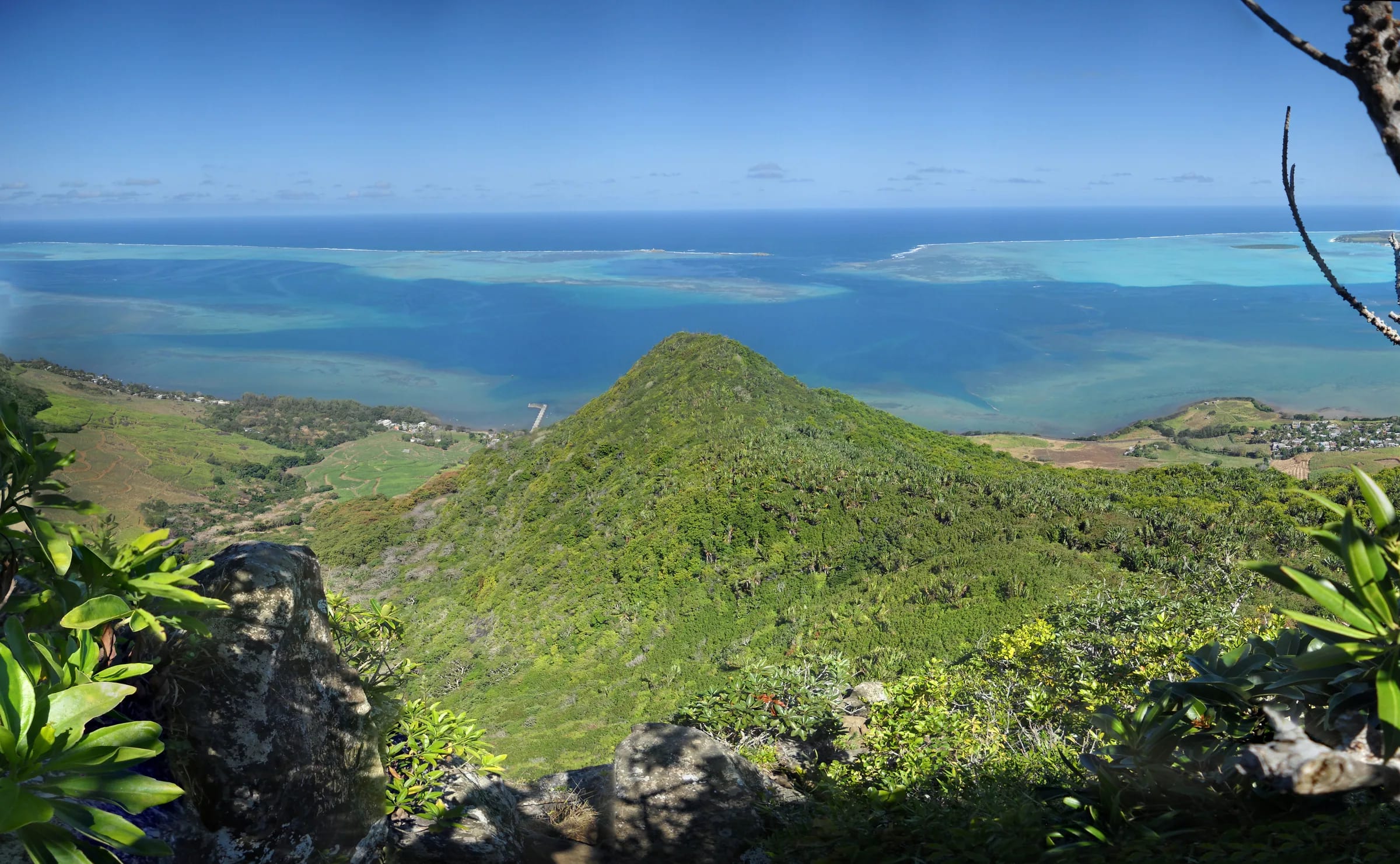
Why the grades disagree so much
Hiking sites grade Lion Mountain across the whole scale. A French GPS route site calls it very difficult. The largest English route app calls it strenuous and warns of true exposure on the head. A Mauritian turn-by-turn guide says it is not physically hard but hard to follow. A hotel’s hiking guide settles on moderate to hard, the French Lonely Planet calls it fairly tough, and users of a German route app grade it T3 to T3+, which is mountain hiking with partly exposed climbing sections. OpenStreetMap tags the path as demanding mountain hiking, the same T3 band.
Each grader is describing a different thing. The effort is moderate, about 400 to 480 m of climbing over 1.8 km, done in well under two hours by most people. The technical ground is harder than the effort, with rock steps, roots, slabs and a summit block where you use your hands. The navigation is harder still on a first visit, because nothing is signed. Separate those three and the grades stop contradicting each other.
| Element | Grade | On the ground |
|---|---|---|
| Effort | Moderate | About 400 to 480 m of climb in 1.8 km, well under two hours up for most people |
| Technical ground | Moderate to hard | Rock steps and slabs that need hands; one recorded track reports using hands for roughly half of the ascent and descent |
| Navigation | Hard on a first visit | Nothing signed in the cane, informal red paint and yellow ribbons higher up, unsigned junctions on the ridge |
| Exposure | Hard | Real drops beside the final steps onto the head, with a safe stopping point just before it |
| Weather dependence | High | Clay and rock stay slippery long after rain, fog can sit on the summit, wind on the open ridge |
Effort, which is steep but short
The numbers are modest. The mapped spine climbs about 400 m in 1.8 km, with the summit somewhere between 440 and 490 m depending on the source, and loops that add the eastern ridge record 470 to 550 m of total ascent. Most people are on the ridge in an hour or so and on the head well inside two hours. There is no long approach, no false summit and no altitude to speak of.
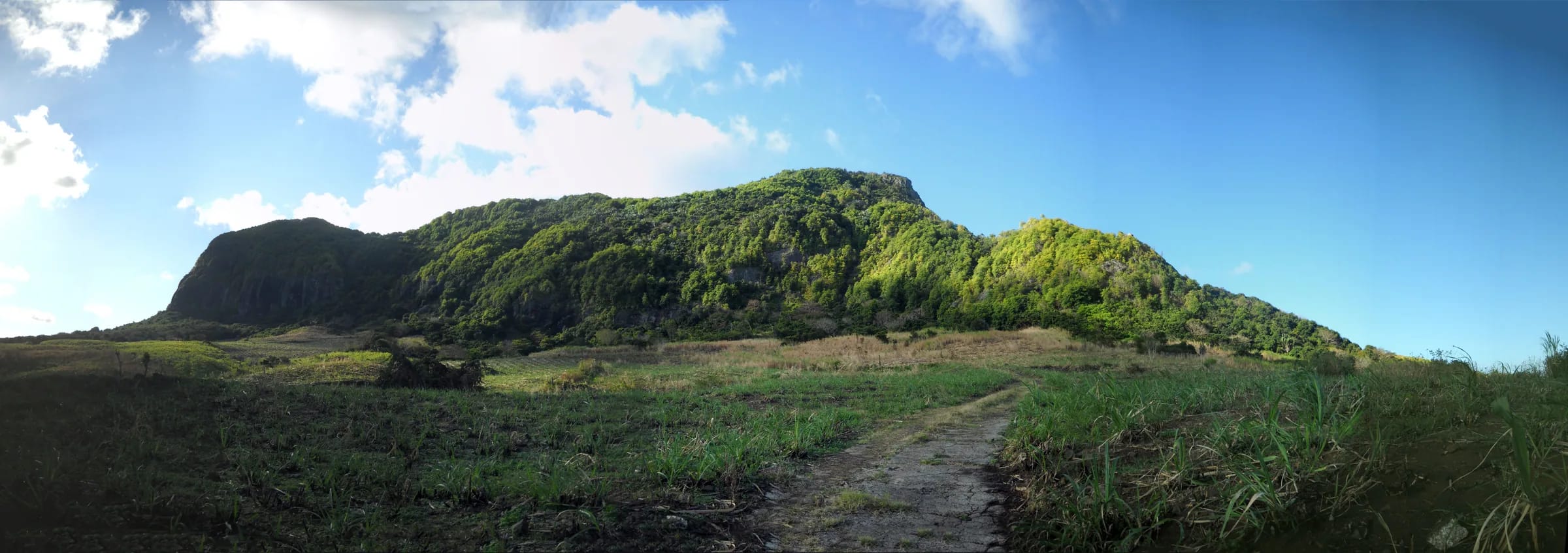
What makes it feel harder than the numbers is the gradient and the heat. The height is gained almost entirely between the big boulder at the end of the cane road and the ridge, on a root-filled drainage line where every step is a step up. Then the upper half has no shade and the basalt radiates. A fit walker who dislikes steep ground will find it tiring; a runner used to hills will find it short. The guided outings exclude people with heart conditions, low fitness or reduced mobility, which is a fair line to draw.
Technical ground and the scrambling
This is where Lion Mountain earns its reputation. The forest climb has rock steps where you reach up for a hold, roots that act as rungs and polished patches where boots have worn the clay away. One recorded track describes using hands for roughly half of the ascent and descent, which is generous for a dry day on the spine and about right for a wet day or for the eastern ridge. Nothing needs a rope, and nothing is climbing in the technical sense, but it is scrambling rather than walking.
Two details catch people out. The first is that the hardest moves are often descended rather than climbed, so a move that felt fine on the way up can feel very different facing outwards on the way down. The second is that the rock is not uniform. Sound basalt steps alternate with crumbly weathered patches and smooth slabs, so test a hold before you commit your weight to it. Shoes with a real sole make more difference here than any other piece of kit.
The lion’s head and the drops
The final section onto the lion’s head is the reason this mountain is graded hard by people who found the rest of it moderate. Inclined slabs and short steps lead onto the summit block with real drops on the bay side. You are never on a knife edge and the moves are short, but the consequences of a slip are serious, and the exposure is enough that one route site simply says to avoid it if you are afraid of heights. Reviewers describe needing sure-footedness and a head for heights, and every source that mentions the head calls it the most exposed part of the route.
The honest advice is also the oldest. Anyone uneasy with drops can stop just before the head. The view from the top of the ridge is already most of the view, the flag viewpoint on the eastern ridge is rated higher than the summit by people who have seen both, and nobody needs to prove anything on a slab above the bay. Decide before you start who in the group will go on and who will wait, so that the decision is made calmly and not on the rock.
How much the weather changes the grade
Grades assume dry rock, and Lion Mountain is on the wet side of the island. The south-east trade winds bring rain to this coast, the thin clay soil drains slowly and stays slippery long after showers, and in the dry season fallen leaves do the same job. Fog and rain can sit on the summit even when the coast is clear. On a wet day the technical ground moves up a grade, the exposure on the head stops being acceptable for most people and the sensible turnaround point is the ridge junction. If it rained hard yesterday, consider a different day or a different mountain.
Who it suits and who should stop before the head
Lion Mountain suits hikers who are comfortable using their hands on rock, happy to navigate without signs and content with a short, intense morning rather than a long day. It suits trail runners looking for a steep objective, photographers who want the bay at first light and anyone who has done a few mountains and wants one with no crowds and no ticket.
It does not suit people who dislike heights, who need a marked path to feel comfortable or who are carrying an injury that would make a steep descent miserable. It is a poor choice as a first mountain for someone who has never scrambled, unless they go with a patient companion and agree in advance to stop before the head.
- Go to the head if you are sure-footed, dry weather is forecast and you are comfortable climbing down the same rock you came up.
- Stop at the ridge junction or just below the head if drops worry you, if the rock is wet or if anyone in the group is tiring. You will have seen the bay, Ferney and the reef by then.
- Stop at the top of the cane road if someone is unwell or the weather has turned. The forest climb is where effort and risk begin together.
- Take a guide if you are new to Mauritian mountains, if you are alone or if the weather is doubtful. The route is free either way.
Compared with Le Morne and Le Pouce
Le Morne Brabant, at 556 m on the south-west tip of the island, is the hike most visitors compare it with. Le Morne is a managed UNESCO World Heritage cultural landscape whose upper section is guided and controlled by the Le Morne Heritage Trust Fund, with a well-trodden path, set hours and company on the trail. Its final section is exposed too, but the route is obvious and busy. Lion Mountain is lower, steeper for its height, unmarked, free and often empty. The scrambling is comparable and the solitude is not.
Le Pouce, at 812 m in the Moka range, is a different proposition again. It is higher and longer, with a walk-in from Petit Verger and a steep summit finish that needs hands for a short stretch, but it has a clear path and far less sustained scrambling than the forest climb on Lion Mountain. Put simply, Le Pouce is the easier mountain to follow and the longer one to climb. Lion Mountain is the shorter one and the harder one to read.
Questions people ask
Is Lion Mountain a hard hike?
Moderate to hard. The effort is modest, about 400 to 480 m of climbing over 1.8 km, but the forest climb is steep enough to need hands, the route is unmarked through the cane and the final steps onto the lion’s head are genuinely exposed. Experienced hikers call it a short, serious morning. People new to scrambling find it harder than its height suggests.
Do you have to scramble on Lion Mountain?
Yes. The climb from the cane road to the ridge has rock steps and roots where you use your hands, and the final section onto the head crosses inclined basalt slabs with drops on the bay side. Nothing needs a rope and no move is technical, but it is scrambling rather than walking, and the same moves must be reversed on the way down.
Is Lion Mountain dangerous?
Not for a careful, sure-footed hiker in dry weather who turns back when conditions are wrong. The specific risks are the exposed head, slippery clay and rock after rain, heat with no water on the route, and the unmarked cane roads in failing light. No incident or closure reports were found for 2023 to 2026, which is reassuring but not proof of anything.
Can a beginner do Lion Mountain?
A fit beginner with a patient companion can climb to the ridge junction and enjoy most of the view, and many do. Going on to the head is a different matter, because it asks for comfort on exposed rock that a first-time scrambler has not yet built. Agree in advance to stop before the head, or choose a guided outing.
Can children climb Lion Mountain?
Older children who already scramble confidently manage the forest climb and the ridge with an adult close behind them. The head is not a place for anyone who cannot be trusted to move calmly beside a drop, and there is no rule or minimum age on this side of the mountain, so the judgement is yours. Our page on hiking with children covers turnaround points in detail.
Is Lion Mountain harder than Le Morne?
Harder to follow, similar to scramble, and quieter. Le Morne is higher at 556 m, with a managed, well-trodden path and a guided upper section. Lion Mountain is about 480 m, unmarked, steeper for its height and often empty. Both have an exposed finish, and on both the honest option is to stop just below it if drops worry you.
Read the safety page before you go
Exposure, wet rock, heat, timing and the emergency numbers that work in Mauritius, written plainly.