
Lion Mountain trail map and GPX
This page carries the live map of Lion Mountain with both mapped lines, the 1.8 km spine from Vieux Grand Port and the 1.7 km eastern ridge, plus the waypoints people actually use and two GPX files to download. Read the notes on accuracy before you trust the line in the cane. The geometry comes from OpenStreetMap and the heights from a 30 m terrain model, which is good enough to plan with and not good enough to follow blindly.
Read the guide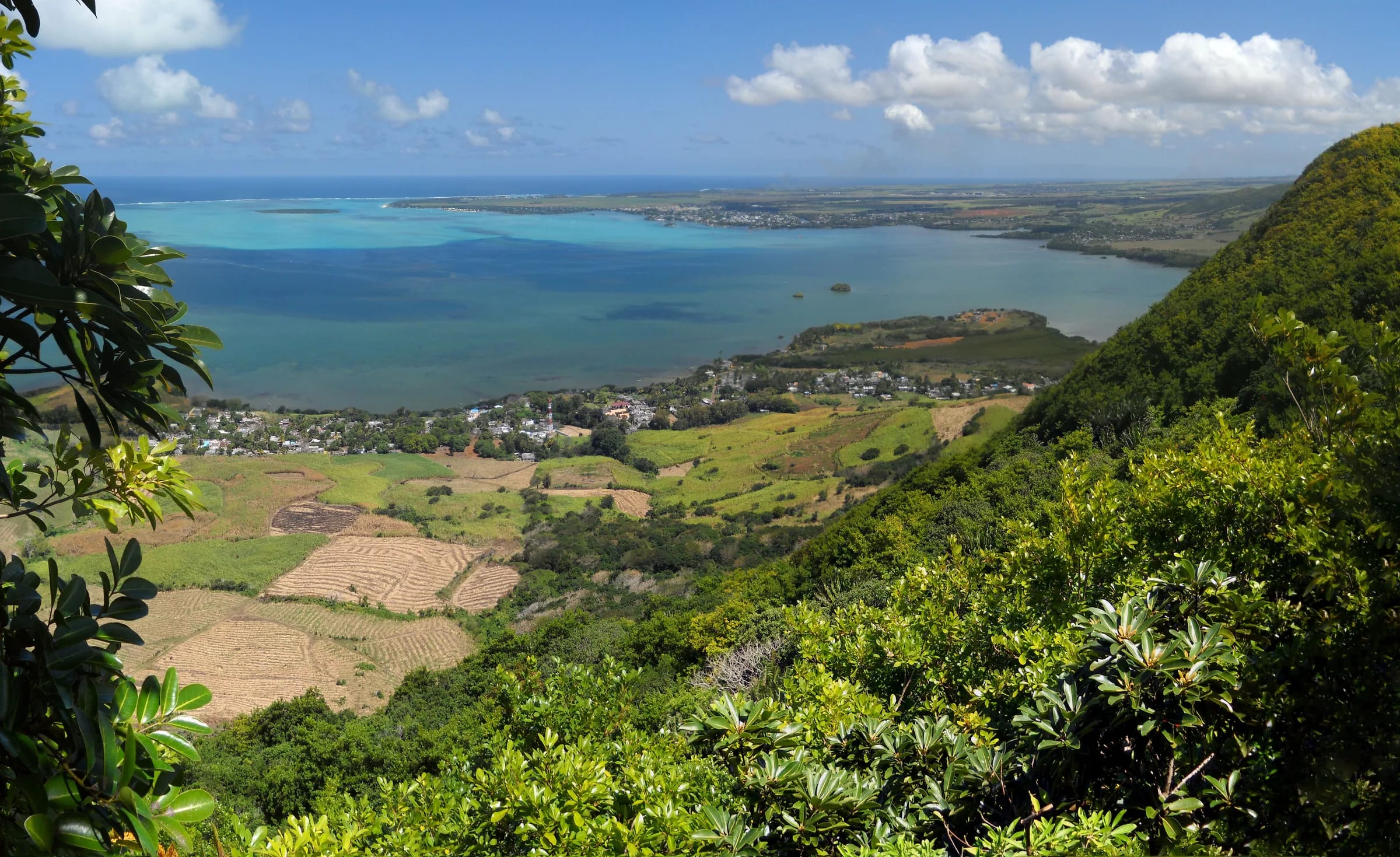
The map and the elevation profile
The map shows the two mapped routes on Lion Mountain and the elevation profile beneath it. The main line is the spine, leaving Vieux Grand Port near the museum and the bus stops and climbing the length of the lion’s back to the summit. The second line is the eastern ridge, which leaves the village slightly further east, climbs past the Eastern Viewpoint and rejoins the spine about 340 m short of the top. Together they make the loop that most recorded tracks describe.
Read the profile for shape, not for the last metres. The heights come from a 30 m terrain model, which averages each cell of ground and so flattens a sharp summit. On the model the spine tops out at about 436 m and ends at 411 m, while OpenStreetMap records the summit at 490 m and most guides use about 480 m. The official height is shown separately for that reason. The same smoothing hides the rock steps on the forest climb and the slabs on the head, so a profile that looks like a steady ramp is steeper and more broken on the ground.
Elevation profile from a 30 m terrain model, which smooths sharp summits. Distances follow the mapped path. Official summit height shown separately.
The two mapped routes
The spine is the standard route and the one every published description follows. From a start about 37 m above the sea it runs 1.8 km to the summit with about 400 m of ascent and only 25 m of descent along the way, so it is a climb from the first cane road to the last slab. OpenStreetMap tags it as demanding mountain hiking, the T3 band on the Swiss scale, with intermediate trail visibility, which matches what hikers report. It passes the ridge junction at about 1.45 km, where the eastern ridge joins from the right.
The eastern ridge is 1.7 km from the village to that junction, starting a little lower at about 27 m and gaining about 360 m. It is rockier and more open than the spine, carries the Eastern Viewpoint with the flag, and is the half of the loop that reviewers find harder to descend than to climb. Walked as a loop, with the out-and-back to the summit from the junction, the mapped geometry comes to about 3.8 km. Recorded GPS loops run to 4.5 to 5 km because people visit viewpoints, wander in the cane and because consumer GPS wobbles under trees.
| Route | Length | Ascent | Start height | Where it ends |
|---|---|---|---|---|
| Spine from Vieux Grand Port | 1.8 km | About 400 m | About 37 m | The summit |
| Eastern ridge | 1.7 km | About 360 m | About 27 m | The spine, about 340 m below the summit |
| Loop, eastern ridge up and spine down | About 3.8 km | About 400 to 480 m | Village | Village |
Waypoints worth knowing
Four places on the mountain are named on the map or used as references by hikers. Their coordinates are given in decimal degrees so that you can type them into any mapping app. None of them is signed on the ground.
- The village start. The mapped spine begins at about minus 20.3727, 57.7258, close to the Frederik Hendrik Museum and the coast road bus stops. The eastern ridge begins at about minus 20.3723, 57.7270. Both are reached from behind the police station, which is the landmark everyone agrees on.
- The ridge junction. About 1.45 km up the spine and 340 m short of the summit, where the eastern ridge joins. Turning left here leads to a viewpoint over the western cliffs by a steep, slippery descent. This is the natural turnaround point in doubtful weather.
- The South-Eastern Viewpoint, at minus 20.36605, 57.72289. On the map this sits just west of the spine, roughly 50 m off the line, which makes it the short spur that one guide describes as the west-cliff viewpoint. The name describes what it looks at, not where it is.
- The Eastern Viewpoint, at minus 20.36557, 57.73005, on the eastern ridge. This is the viewpoint with the Mauritian flag on the rocks and the outlook Komoot users rate at 5.0 from 23 ratings under the name View of Mahébourg and the sea from Lion Mountain. Several reviewers prefer it to the summit, where trees screen part of the view.
- The summit, at minus 20.3611505, 57.7252789, recorded at 490 m on OpenStreetMap and about 480 m in most guides. Wikipedia gives minus 20.36121, 57.72489 and 440 m, taken from a 2004 stamp series. The last few metres onto it are the exposed slabs.
The GPX files and their limits
Two files are available from this site. The spine is at /downloads/lion-mountain-trail.gpx and the eastern ridge at /downloads/lion-mountain-eastern-ridge.gpx. Both contain the mapped geometry with the terrain-model heights attached to each point. They are free, carry no warranty and should be treated as a planning aid rather than a guide rope. The geometry is © OpenStreetMap contributors, released under the Open Database Licence, and the same applies to the files.
Know what they are made of. The lines come from OpenStreetMap, which means they were drawn by volunteers from aerial imagery and uploaded GPS tracks rather than surveyed on the ground, and the trail visibility tag is intermediate. Horizontal accuracy is a few metres in the open and can be tens of metres under the forest canopy, which is also where your phone’s own fix will wander. The heights are from a 30 m model, so expect the profile to read 40 to 50 m low at the summit and to hide every rock step. The cane roads shift with the harvest, so the mapped line through the cane may not match the road that is actually open this season. A Mauritian hiking guide publishes its own GPX of the loop, and comparing two independent lines is never wasted effort.
How to load the GPX on your phone
Most hiking and mapping apps import GPX files directly, and the steps are the same on any of them. Do this at home or at your accommodation, on Wi-Fi, the evening before.
Download both files
Save the spine and the eastern ridge to your phone. You want both even if you plan to go up and down the spine, because the eastern ridge is your reference if you end up on the wrong crest.
Import them into a mapping app
Open each file with an app that reads GPX. On most phones you can tap the downloaded file and choose the app from the list; otherwise use the app’s own import or open command and browse to the download folder.
Download offline map tiles
Save the map for the Grand Port area for offline use, zoomed in far enough to show the cane roads. The track alone, drawn on a blank screen, tells you less than the track on a map, and you should not count on mobile data on the ridge.
Check it displays and record your own track
Before leaving, confirm the lines show and your position appears on them. On the day, record your own track from the police station. If you lose the line, your own trail back is the surest way down.
Look after the battery
Screen on with GPS running drains a phone fast in heat. Check the map at junctions rather than walking with it in your hand, carry a small power bank if you have one and keep a headlamp as your light, not the phone.
Why the trail still needs your attention
A line on a screen is not a path. Through the sugar cane there is no marking at all and the farm roads change, so the mapped line may cross a field that is now planted or follow a road that has been re-cut 30 m to one side. Keep the centre of the mountain ahead of you and use the track to confirm, not to steer. Higher up, the informal marks are red paint on rock and yellow ribbons on branches with long gaps between them, and the junctions on the ridge are unsigned. Several recorded reviews describe the path as poorly marked, especially through the cane, and one guide calls the whole route easy to walk and hard to follow.
The map also cannot tell you about conditions. Clay stays slippery long after rain, fallen leaves do the same in the dry season, fog can sit on the ridge, and the slabs onto the head are exposed in every season. If you lose the line, go back to the last point you were sure of. If the ground steepens unexpectedly, you are off the route, because the spine never asks for more than a scramble. The village and the coast road are downhill to the south-east, which is reassuring, but the direct way down is not always the safe way, so retrace rather than shortcut.
Questions people ask
Is there a map of the Lion Mountain trail?
Yes, the live map on this page shows both mapped routes, the spine from Vieux Grand Port and the eastern ridge, with an elevation profile, and two GPX files are available to download. The geometry comes from OpenStreetMap and the heights from a 30 m terrain model, so use it for planning and confirmation rather than as a precise survey.
Is the Lion Mountain trail marked?
No. The cane roads at the bottom are unmarked and the waymarks higher up are informal red paint and yellow ribbons with gaps between them. The ridge junction is unsigned. OpenStreetMap tags the path as intermediate visibility, and recorded reviews call it poorly marked, especially through the cane, which is exactly where a GPX track helps most.
How long is the Lion Mountain loop?
About 3.8 km on the mapped geometry, climbing the eastern ridge, visiting the summit from the junction and descending the spine. Recorded GPS loops come in at 4.5 to 5 km because people visit viewpoints, wander in the cane and because phone GPS drifts under trees. A simple out-and-back on the spine is 3.6 km.
How accurate is the elevation profile?
Good for shape, low at the top. The heights come from a 30 m terrain model that averages each cell of ground, so the spine reads about 436 m at its highest point while the summit is recorded at 490 m on OpenStreetMap and about 480 m in most guides. The model also smooths the rock steps and slabs, so the real climb is more broken than the profile.
Where is the flag viewpoint on Lion Mountain?
On the eastern ridge at about minus 20.36557, 57.73005, named Eastern Viewpoint on the map. A Mauritian flag is fixed to the rocks there, Komoot users rate the outlook over Mahébourg and the sea at 5.0, and several reviewers prefer it to the summit, where trees screen part of the view. It is reached by the eastern half of the loop.
Which app should I use for the GPX file?
Any hiking or mapping app that imports GPX and stores offline maps will do. Load both files the evening before on Wi-Fi, download the map tiles for the Grand Port area, confirm your position shows on the line and record your own track from the police station so that you can retrace it if you lose the way.
Find the start
The trailhead page shows where the trail leaves the coast road, where to park and which landmarks to trust.