
Vieux Grand Port
Vieux Grand Port is a coastal village of about 3,000 people on the north shore of the bay of Grand Port, directly under Lion Mountain. It is the oldest settlement on the island, the place where the Dutch came ashore in 1598 and built their fort forty years later, and it is where the hike up the lion’s back starts, behind the police station on the coast road.
Read the guide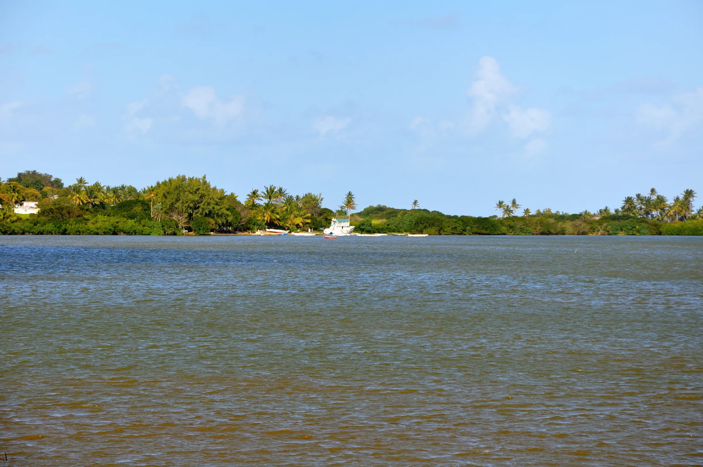
The oldest settlement on the island
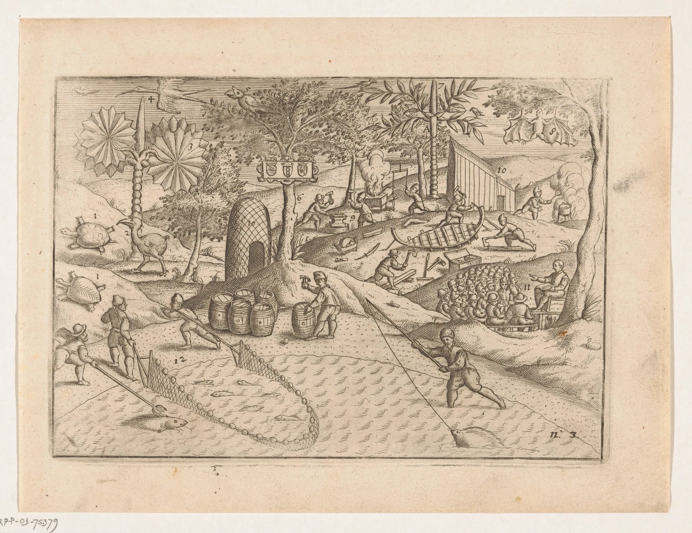
Recorded history in Mauritius begins in this bay. In September 1598 the ships of Wybrand van Warwijck, part of the second Dutch expedition to the East Indies under Jacob Cornelisz van Neck, anchored in the sheltered water and named it Port de Warwick. The island itself they named after Maurits van Nassau, the stadtholder. Sources give 17, 18 or 20 September for the landing. The 20th is the date most often used and the one associated with the monument, and this guide follows it while noting the spread.
The Dutch came back to stay in 1638, when Cornelius Gooyer and 25 men founded the first permanent settlement and built Fort Frederik Hendrik, named after Frederick Henry, Prince of Orange, as a refreshment station for the Dutch East India Company. One account dates the decision to 1637. The station cut ebony for export with enslaved labour brought from Madagascar, struggled through cyclones, droughts, pests and illness, and was abandoned in 1658. A second occupation ran from 1664 to 1710. A cyclone in 1695 wrecked the wooden fort, a stone lodge was built in 1698, and when the Dutch left for good in 1710 they burned everything but that lodge.
The French claimed the island in 1715 and settled from 1722, governing briefly from this same site before moving to Port Louis. From 1753 a French government complex of lodge, prison, bakery and smithy rose on the Dutch ruins, and the place remained a military post until 1806, when the post moved to the new town of Mahébourg across the bay. Vieux Grand Port, old Grand Port, is the name it has carried since.
The village today
The 2011 census counted 2,969 people in Vieux Grand Port. It is a strip of houses, small shops and a police station along the B28 coast road, called Royal Road through the village, with cane fields rising behind it to the foot of the mountain and the lagoon in front. There is no hotel strip and no beach resort. It is a working village rather than a destination, which is a large part of why the trailhead feels the way it does.
The shore has a small jetty, and the map records a viewpoint on the coast beyond the village where you can look back at the mountain across the cane. Out in the lagoon lie the islets off Vieux Grand Port and, further south, Île de la Passe at the reef entrance, where the fort whose guns opened the Battle of Grand Port still stands as a protected ancient monument.
For visitors the village has four things, the museum and fort ruins, the Dutch landing memorial, the trailhead, and the bus stops on the coast road. All of them lie within a few hundred metres of each other, which makes it easy to combine the museum with the hike in a single morning.
The Frederik Hendrik Museum and the fort ruins
The museum stands on Royal Road at the southern end of the village, on the colluvial fan at the foot of Lion Mountain where the Dutch built their fort. The site was rehabilitated and landscaped for the 400th anniversary of the landing in 1998 and inaugurated by Prince Maurits van Oranje-Nassau. The museum opened on 27 May 1999 with a first exhibition donated by the Dutch government. One encyclopaedia entry gives 2010 instead, which may refer to a later phase, and this guide follows the Mauritius Museums Council’s date.
Archaeologists from Rutgers University and the University of Amsterdam excavated the site over several seasons between the late 1990s and the mid 2000s. The accounts differ on the exact years, but the finding is consistent. The Dutch layers lie about 50 cm below the French structures, and the wall of the stone lodge of 1698, the one building the Dutch did not burn in 1710, was the key discovery. The ruins are laid out in the grounds, crossed by the small Fosse Hollandaise stream, so you can walk the plan of the fort and the later French complex in a short visit.
Admission is free. With the Mahébourg Naval Museum closed for renovation since December 2025, this is currently the one museum in the bay you can actually walk into. The telephone number is (230) 634 4319.
| Day | Hours |
|---|---|
| Monday, Tuesday, Thursday, Friday, Saturday | 09:00 to 16:00 |
| Wednesday | 11:00 to 16:00 |
| Sunday | 09:00 to 12:00 |
| Public holidays | Closed |
The Dutch First Landing memorial
Beside the coast road at the base of the mountain, overlooking the bay on the Ferney side of the village, stands the Dutch First Landing memorial, a listed National Heritage Site. It marks the anchorage of September 1598 and is the obvious place to stand if you want to picture the ships of Van Warwijck in the lagoon with the lion behind you. The Vallée de Ferney’s own trails leave the B28 just north of it.
Do not confuse the two Dutch sites. The memorial marks the landing of 1598; the fort and museum mark the settlement of 1638. They are a few minutes apart along the coast road, and the Dutch landing page on this site tells the story of the first in detail.
Where the hike starts
The Lion Mountain trail leaves the village from behind the police station, towards the northern end of the village on the coast road. There is no official car park. Hikers leave cars on the street near the police station or by the shop about 20 m along the main road. There is no entrance fee and no permit for the route from this side, and no opening hours either, which is why an early start is entirely in your hands.
From behind the police station a track leads back through the cane towards the middle of the mountain, and the climb proper begins where the cane road curves away and the path goes straight on. The route is unmarked through the cane and only informally marked higher up with red paint and yellow ribbons. One blog mentions a concrete bridge and two red arrows painted on a wall near the start, which we have not been able to confirm. The trailhead guide has the detail and the hiking guide covers the climb itself.
Getting to the village and the buses on the coast road
By car, Vieux Grand Port is about 13 km from the airport, roughly a quarter of an hour, and the Vallée de Ferney turn-off is signposted on the coast road about 2 km south of the village. From Mahébourg you follow the coast road around the head of the bay, with the mountain growing in front of you the whole way.
By bus, the picture is less tidy. Stops named Old Grand Port, Bambous Virieux and Grand Sable exist on the B28, and the map shows a string of stops through the village, but no route number for a Mahébourg to Vieux Grand Port service is published online. Rural services run roughly from 06:30 to 18:30. Ask at the Mahébourg terminal for the coast road bus towards Bambous Virieux, and allow for a slow ride. For a dawn start, a taxi from Mahébourg, Blue Bay or Pointe d’Esny is the realistic choice.
Bois des Amourettes and Pointe du Diable along the coast
North of the village the coast road runs under the mountain’s eastern flank to Bois des Amourettes, a village of about 1,900 people wedged between Lion Mountain and the bay. The road here is one of the two classic places to see the lion in profile, the other being the Mahébourg waterfront. There is no documented trail up the mountain from this side, so admire it and carry on.
Beyond Bambous Virieux, near Grand Sable, is Pointe du Diable, a French coastal battery beside the main road with restored fortifications and cannons along about 250 m of shore. It is about 7 km from Vieux Grand Port. Its construction date and original armament are not established in the sources we have, and the story that compasses misbehaved here, which is said to give the point its name, is unverified. Ruined Second World War installations stand nearby.
Eating in and around the village
Vieux Grand Port has shops for water, bread and snacks, which is what you need before the climb, but it is not a place to plan a meal around. The choice is in Mahébourg, where street food around the market and a handful of sit-down restaurants along Royal Road and the waterfront serve Mauritian cooking and fish. At the Vallée de Ferney, 2 km south, the estate’s restaurant serves lunch with a view back over the bay and the mountain, with venison from the estate on the menu.
Carry your own water for the hike regardless. There is none on the route, and you should not count on the village shop being open for a dawn start.
Questions people ask
What is Vieux Grand Port known for?
Three things. It is the oldest settlement in Mauritius, where the Dutch anchored in September 1598 and built Fort Frederik Hendrik in 1638. It holds the Frederik Hendrik Museum, free to enter, with the excavated fort ruins in its grounds. And it is the trailhead village for Lion Mountain, whose path leaves from behind the police station on the coast road.
Where exactly did the Dutch land in Mauritius?
In the bay of Grand Port, at what is now Vieux Grand Port, under Lion Mountain. Wybrand van Warwijck’s ships anchored in September 1598, named the bay Port de Warwick and the island after Maurits van Nassau. Sources give 17, 18 or 20 September; the 20th is the date most often used. The Dutch First Landing memorial beside the coast road marks the spot.
Is the Frederik Hendrik Museum free?
Yes. Admission is free. It opens Monday, Tuesday, Thursday, Friday and Saturday from 09:00 to 16:00, Wednesday from 11:00 to 16:00 and Sunday from 09:00 to 12:00, and is closed on public holidays. The telephone number is (230) 634 4319. The ruins of the Dutch fort and the French complex that followed it are laid out in the grounds.
Is there a beach at Vieux Grand Port?
Not a swimming beach. The village shore is a working coast with a small jetty and views of the lagoon and its islets rather than sand for bathing. For a swim after the hike, drive around the bay to the public beach at Blue Bay, south of Mahébourg, which is inside the marine park and free to use.
How do I get to Vieux Grand Port by bus?
With patience. Bus stops exist all along the coast road through the village, and stops called Old Grand Port, Bambous Virieux and Grand Sable are listed, but no route number for the Mahébourg to Vieux Grand Port stretch is published online. Rural buses run roughly 06:30 to 18:30. Ask at the Mahébourg terminal for the coast road service, or take a taxi for an early start.
Can I visit the museum and hike the mountain on the same day?
Easily. The museum is a few hundred metres from the trailhead. Climb at first light, when the slope is cool and the light on the bay is best, and most hikers are back in the village within three to four hours. The museum opens at 09:00 on most days, 11:00 on Wednesday and only in the morning on Sunday, so the ruins make a natural end to the outing.
What is the difference between Grand Port, Vieux Grand Port and Mahébourg?
Grand Port is the bay and the district. Vieux Grand Port, old Grand Port, is the village on the north shore under Lion Mountain where the Dutch settled. Mahébourg is the town laid out around 1806 on the south-west shore when the military post moved there. Visitors sometimes read that Grand Port is the old name of Mahébourg, which is loose.
Find the start of the trail
The trailhead guide shows where to leave the car, which way to turn behind the police station and how to find the first markers in the cane.