Drones on Lion Mountain and the airport
The lion’s head is about 9 km in a straight line from the runway of Sir Seewoosagur Ramgoolam International Airport, and aircraft on approach pass within sight of the summit. That puts the whole mountain inside the airport’s controlled airspace, and Mauritius has had a complete set of drone regulations in force since 1 January 2025. The short version is that you should not fly a drone here without written authorisation from the Department of Civil Aviation. This page explains why, what the rules say and where the published penalty figures disagree.
Read the guide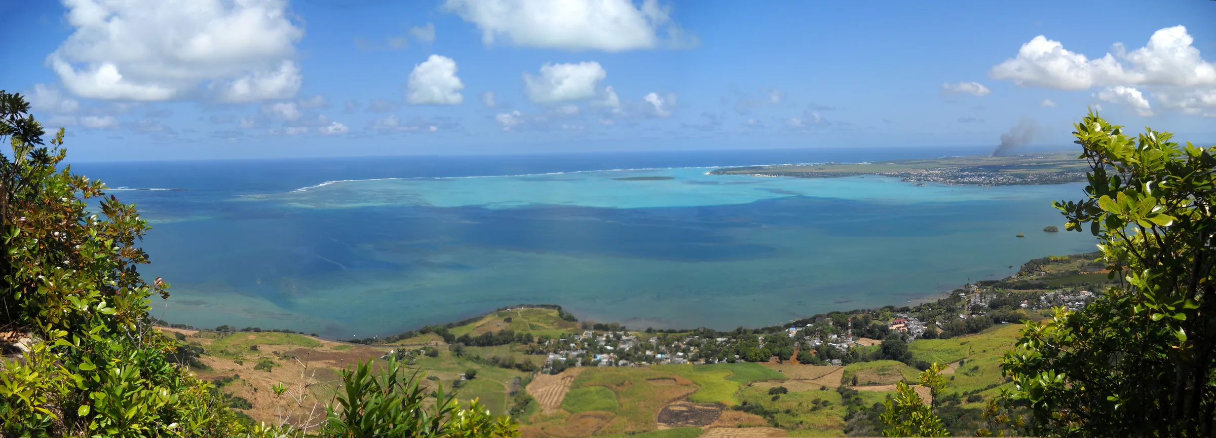
How close the airport really is
The summit of Lion Mountain lies about 8.8 km from the airport reference point and the trailhead in Vieux Grand Port about 7.4 km, both measured in a straight line. The runway is 3,040 m long and sits at 57 m above sea level at Plaine Magnien, and from the lion’s head you look straight down onto it across the cane. Passengers landing from the sea see the mountain on the left side of the aircraft.
The airport’s control zone is not a simple circle. The published boundary is a polygon bounded by arcs of 8, 11 and 13 nautical miles from the airport depending on direction, roughly 15 to 24 km, and it extends from the surface to 3,500 ft. It is Class C airspace, where no drone may fly without permission. Even the smallest of those arcs, 8 nautical miles, is close to 15 km, so Lion Mountain at about 9 km sits comfortably inside it. You may read other radii quoted on travel blogs. None of them has an official source, and the control zone arcs are what matter.
The regulations in force
Drone flying in Mauritius is governed by the Civil Aviation (Unmanned Aircraft System) Regulations 2024, published as Government Notice No. 232 of 2024, which took effect on 1 January 2025. They revoked Regulations 91, 91A, 91B and 91C of the Civil Aviation Regulations 2007, which had been the rules until then. The Department of Civil Aviation publishes the regulations on its drone requirements page alongside a fees amendment made in 2026, a technical standard called MCAR-UAS at Issue 01 Revision 01 dated September 2026, and application forms for registering a drone, registering an operator and seeking approval for operations in the open and specific categories.
The structure follows the international pattern. Drones and their operators are registered, flights are divided into an open category with fixed limits and a specific category that needs an individual approval, and anything near an aerodrome or over people falls outside what a casual flyer may do. The Department has also published a list of approved commercial operators, dated 21 July 2026, which is the route by which professional filming inside controlled airspace is arranged.
What the DCA’s own FAQ says
The Department’s frequently asked questions document, updated on 22 August 2024, predates the new regulations but is still published and still sets out the plain rules for leisure flying. It applies to drones under 7 kg used for recreation and says no permission is needed for them, provided the pilot keeps to these conditions.
For commercial or aerial work, the same document lists further restrictions on permitted operators, including no flying within Class C airspace or an aerodrome traffic zone, no flying over congested areas or within 150 m of them, and no flying over open-air assemblies of more than 500 people.
- Fly only during the day.
- Fly only within a private property, and only with the owner’s permission.
- Do not exceed a height of 400 ft above the surface.
- Do not operate over any area where the public can gain access, including beaches, and do not operate in the vicinity of the airport.
- Keep the drone within the pilot’s line of sight at all times.
- Comply with the Data Protection Act when capturing images of people.
Why Lion Mountain fails every test
Set the mountain against those rules and it does not pass one of them. The trail and the summit are areas where the public can gain access, which is the whole point of them. The ground is not your private property and the cane fields below belong to someone else. The summit is about 9 km from the runway, which is the vicinity of the airport by any reading, and the entire mountain lies inside the Class C control zone where drones are prohibited without permission. A 400 ft ceiling above a 480 m summit still puts the aircraft inside that controlled airspace, which reaches 3,500 ft.
There is also the obvious physical point. Aircraft on approach from the sea pass within sight of the summit, and a small drone lifted off the lion’s head is in the same piece of sky as a landing airliner. The rules exist for that reason, and nothing about a quiet morning on the ridge changes it.
Registration and vetting
Under the 2024 Regulations, a drone is registered under Regulation 5 and its operator under Regulation 7, and no registration is granted until the Commissioner of Police is satisfied that the applicant, and anyone else who will fly the aircraft, is qualified to operate it. The Department states a minimum of three months for the procedure, including the police checks, which is longer than most holidays. A 2026 amendment introduced fees of Rs 2,000 for a drone and Rs 1,500 for an operator, applying to applications received from 22 July 2026.
Bringing a drone into the country is a different question from flying it. The older FAQ states that no special permission is needed to arrive in Mauritius with a drone for a holiday, and that no pilot licence is required for leisure flying. What you may then do with it is governed by the rules above, and on this mountain the answer is nothing without authorisation. Forms and enquiries go to the Department by email at civil-aviation@govmu.org.
Penalties, and where the figures disagree
Two different penalty figures are in circulation and this guide will not pretend they agree. The Department’s FAQ, written under the old Regulation 91 regime, states that failure to comply is an offence under Regulation 137 of the Civil Aviation Regulations and that under the Civil Aviation Act a person convicted is liable to a fine not exceeding 100,000,000 rupees and imprisonment for a term not exceeding 12 months. A detailed secondary guide to the 2024 Regulations states that Regulation 22 of the new rules sets a fine of up to one million rupees and up to twelve months’ imprisonment, with the two penalties cumulative, and notes that the new rules contain no provision for confiscating the aircraft.
The difference is a factor of a hundred, and the honest position is that the older figure comes from the regulator’s own document and the newer from a secondary reading of the regulations now in force. Which ceiling a court would apply to a flight on Lion Mountain in 2026 is a question for a lawyer. What is not in doubt is that the imprisonment term is twelve months in both versions, that the offence is a criminal one, and that a visitor filming the lagoon from above the lion would be committing it inside the control zone of an international airport.
What to do instead
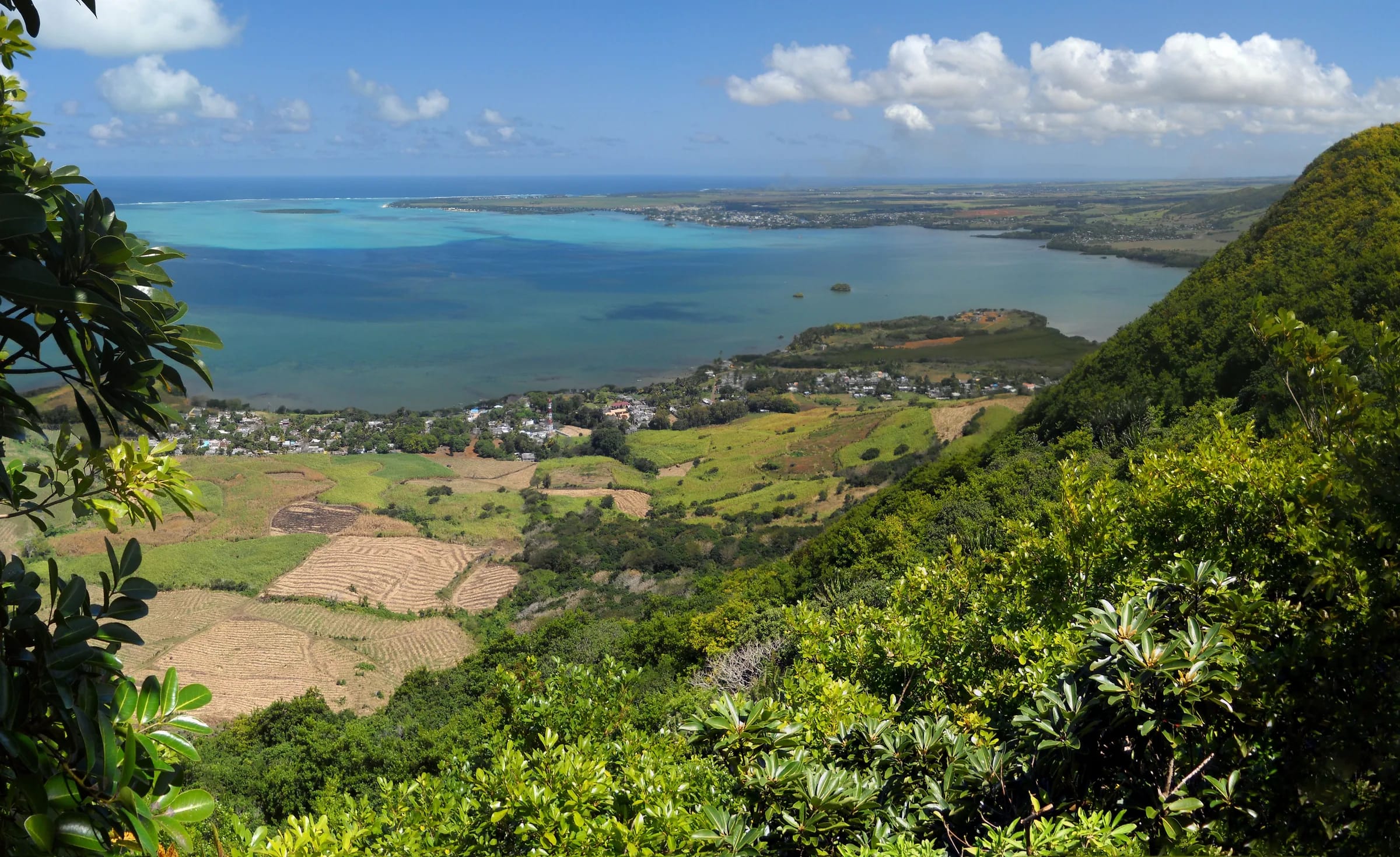
The view from the lion’s head is the aerial shot, and you reach it on foot. The summit looks down on the whole bay of Grand Port, Île aux Aigrettes, Mahébourg and the runway itself, and the eastern viewpoint with its flag gives the cleanest line over the lagoon. A phone or camera from those rocks gets most of what a drone would, with nobody’s approach path involved. The photography page on this site covers the light and the viewpoints.
- Photograph from the summit and the eastern viewpoint rather than from the air.
- If you need aerial footage for a professional project, approach a DCA-approved commercial operator and allow months, not days.
- For any other question, write to the Department of Civil Aviation at civil-aviation@govmu.org before you travel, not from the village.
- Do not fly here on the assumption that a quiet morning means nobody is watching. The airport is.
Questions people ask
Can I fly a drone on Lion Mountain?
Not without written authorisation from the Department of Civil Aviation. The summit is about 9 km from the international airport, inside its Class C control zone where drones are prohibited without permission, and the leisure rules forbid flying in the vicinity of the airport or over any area the public can access. The trail and summit are both public. Treat the answer as no unless you hold a specific DCA approval.
Is Lion Mountain inside the airport no-fly zone?
Yes. The airport control zone is bounded by arcs of 8, 11 and 13 nautical miles, roughly 15 to 24 km, from the surface to 3,500 ft, and the summit sits about 9 km from the airport reference point. That places the whole mountain inside even the smallest arc. Radii quoted on travel blogs have no official source, and the published arcs are what count.
Do I need to register my drone in Mauritius?
Under the Civil Aviation (Unmanned Aircraft System) Regulations 2024, in force since 1 January 2025, drones are registered under Regulation 5 and operators under Regulation 7, and registration depends on the Commissioner of Police being satisfied that the pilot is qualified. The Department states the process takes at least three months. Fees of Rs 2,000 and Rs 1,500 apply to applications from 22 July 2026.
What is the penalty for flying a drone illegally in Mauritius?
Published figures disagree. The Department of Civil Aviation’s older FAQ cites a fine not exceeding 100,000,000 rupees and up to 12 months in prison under the Civil Aviation Act. A secondary guide to the 2024 Regulations gives Regulation 22 as up to one million rupees and up to twelve months, cumulatively. Both agree on the prison term and on the offence being criminal.
Can I bring my drone to Mauritius on holiday?
Yes. The Department’s FAQ states that no special permission is needed to enter the country with a drone and that no pilot licence is required for leisure flying. Flying it is another matter. Leisure flights are allowed only by day, over private property with the owner’s permission, below 400 ft, within line of sight and away from the airport and any area open to the public, which rules out Lion Mountain entirely.
Can a professional film Lion Mountain from the air?
Only with specific authorisation from the Department of Civil Aviation, normally through an operator on the Department’s list of approved commercial UAS operators, who must hold insurance, an operations manual and an approval for operations in the specific category. Because the mountain lies inside the airport control zone, expect the process to take months rather than days and to be refused if the case is weak.
Get the aerial view on foot
The photography page covers where the lion reads best, what light to wait for and the viewpoints along the ridge.