
The geology of Lion Mountain
Lion Mountain is a piece of the oldest Mauritius. The ridge belongs to the deeply eroded eastern shield of the island’s first volcano, built over the Réunion hotspot roughly ten to five million years ago, and what you walk on is weathered basalt under a thin clay soil. Nobody has published a dated study of the mountain itself, so this page explains what is known about the island and is honest about what is not.
Read the guide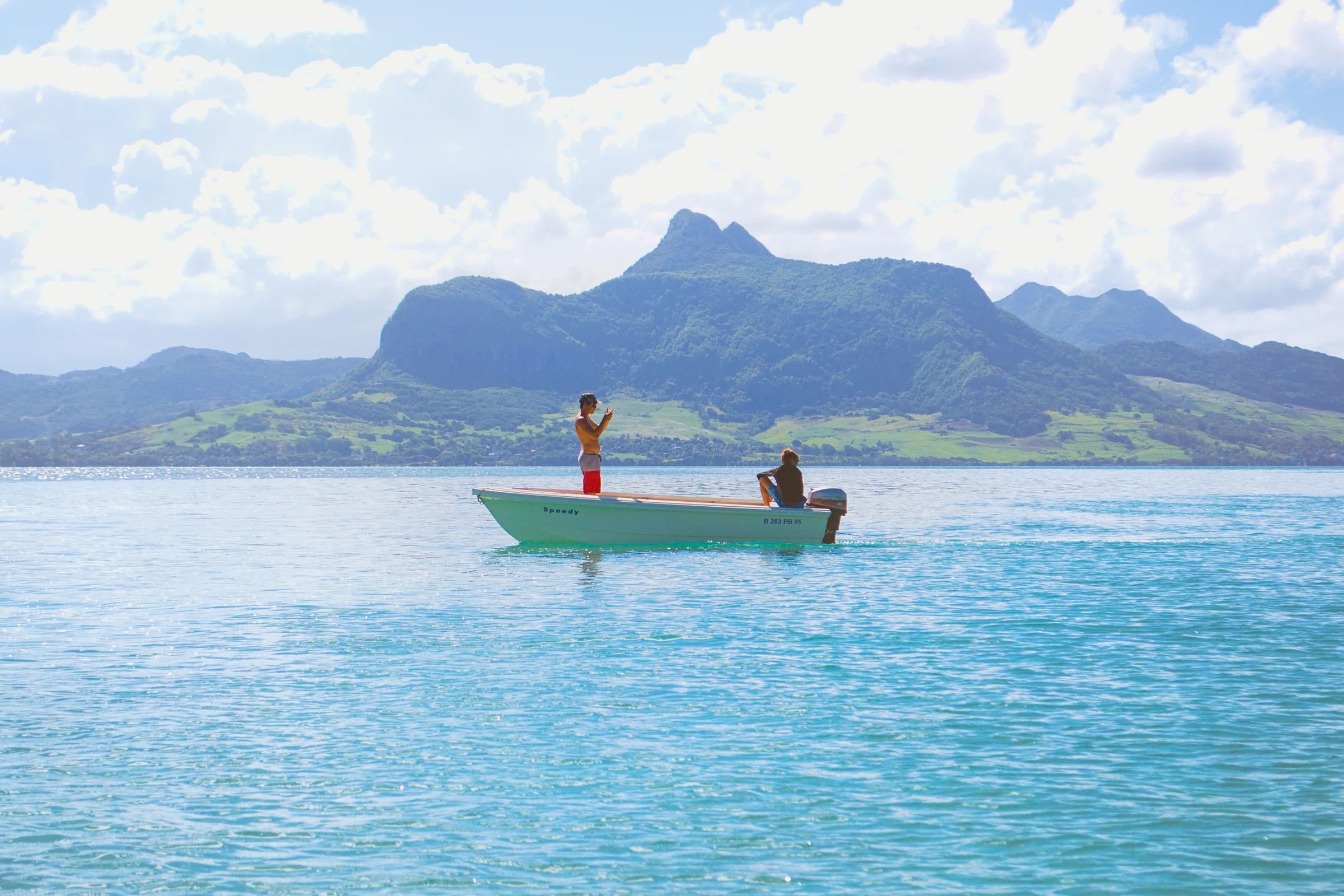
An island built by a hotspot
Mauritius is the top of a volcano. The island sits on the track of the Réunion hotspot, a plume of hot rock rising through the mantle that has stayed roughly in place while the floor of the Indian Ocean drifted over it. Réunion, the island that gives the hotspot its name, lies over the plume today. Mauritius lies further along the track and is older, which is why nothing has erupted here since people arrived and why its mountains are worn into ridges and pinnacles rather than smooth cones.
Geologists describe the island’s volcanic history in phases. The oldest rocks are grouped as the Breccia Series and the Old Series, erupted from roughly ten million years ago down to about five million years ago. A long pause followed, then the Intermediate Series between about 3.5 and 1.7 million years ago, and finally the youngest flood basalts, erupted from about 700,000 years ago until as recently as about 20,000 years ago. A potassium-argon dating study published in 2023 and 2024 broadly supports this picture, with the main shield built from before 8.9 million years ago down to about 4.7 million years ago and later rejuvenation at 3.5 to 1.9 million years ago and again under 0.7 million years ago.
The Older Series and the eastern shield
The Old Series is the Mauritius you see from any high point. It was a large shield volcano, and its rocks are mainly olivine basalt and agglomerate with trachyte intrusions and trachyandesite plugs. Over millions of years of tropical rain the shield was cut into deep valleys and sharp ridges, and the later eruptions then filled the centre of the island with younger lava. What stands above that younger surface today is the rim of the old shield, the ring of steep mountains around the edge of the island, and the eastern ranges are the clearest example of it.
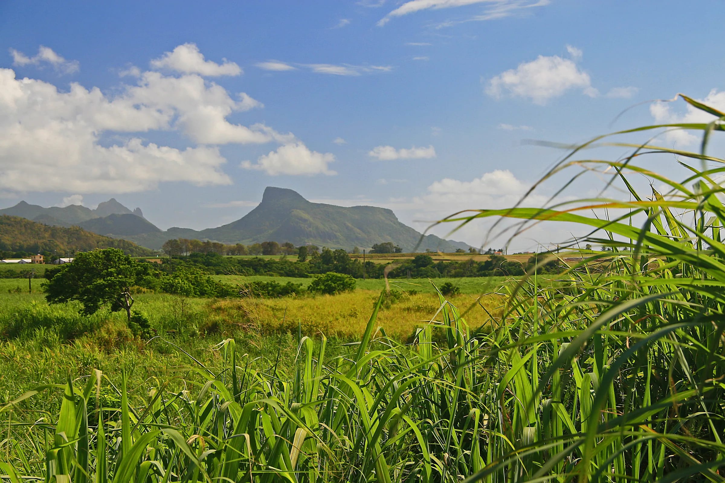
On the east side there are three parallel chains, and the Bambous range is the highest and most extensive. It runs for about 12 km between Montagne Chat and Montagne Table à Perrot. Its highest point, Montagne Bambou, reaches about 630 m, with BirdLife giving 626 m and a hill database 631 m, and Pic Grand Fond reaches 521 m. Lion Mountain, at about 480 m, is the range’s southern outlier, pushed forward towards the coast so that it stands alone between the Vallée de Ferney and the bay of Grand Port. The Key Biodiversity Area that covers these mountains runs from about 60 m to 560 m above sea level, which tells you how far the eastern rim has been worn down compared with the summits of over 800 m in the south-west and north-west of the island.
Why nobody has dated Lion Mountain itself
It would be satisfying to write that the rock of the lion’s head is so many million years old. The honest position is that nobody knows to that precision. The dating studies that exist sample the island’s lava sequences as a whole, and no peer-reviewed paper found while researching this guide ties Lion Mountain to a dated unit. The mountain is part of the eroded eastern shield, so it is reasonable to say that its rock is several million years old and belongs to the Old Series. A precise age for this particular ridge would be an invention, and you will not find one here.
The gap is not unusual. The eastern mountains have had far less geological attention than the central plateau or the coast, and they have no formal protected status to attract survey money. If a dated study appears, this page will be updated to say so.
How erosion made a lion
Volcanoes do not erupt lions. The shape is the product of erosion working on a ridge of resistant rock for a very long time. Picture the original shield as a broad dome. Rain, and on this side of the island a great deal of it carried in by the south-east trade wind, cut valleys back into the dome. Where the rock was softer or more broken the valleys deepened and widened. Where it was harder the ground stayed high. The Ferney valley to the north-west and the coastal lowland of Grand Port to the south-east are two of those lowered areas, and the narrow spine left between them is Lion Mountain.
Seen from Mahébourg the spine rises gently from the south, which hikers call the lion’s back, and ends in the abrupt rocky block of the head at the northern end. A harder knob of rock at the end of a ridge is a common result of this kind of erosion, and the exposed rock steps that make the final part of the climb feel so airy are simply the places where the softer material has gone and the solid core remains. None of this has been written up for Lion Mountain specifically, so read it as the standard explanation applied to this ridge rather than a published conclusion.
Basalt and clay underfoot
Whatever the precise age, the rock behaves consistently. The ridge is weathered basalt. Where the surface has been exposed to the weather for a long time it breaks down into a thin, clay-rich soil that drains slowly and stays greasy long after a shower. Reviewers describe mud in the wet months and slippery dry leaves lying on the clay in the dry ones. Where the rock is bare, which is the case on much of the upper ridge and on the lion’s head, it is dark, solid and grips well when dry, and thousands of boots and hands have polished the obvious holds to a shine.
The steep drainage line that leads up from the cane fields to the ridge is full of roots because that is where the water runs, and the roots are the handholds. On the head itself hikers describe using their hands on volcanic rock faces, and one summary says you use all four limbs for roughly half of the ascent and descent. That is the geology translated into effort. Shoes with real grip matter more here than on a longer but smoother mountain, and the difficulty page on this site goes into what that means for different hikers.
The colluvial fan at the foot of the mountain
At the bottom of the mountain the story changes from rock to rubble. Material that erodes off a ridge does not vanish. It collects at the foot as colluvium, the mixed soil and stone that slides and washes downslope and builds a gentle fan between the steep ground and the shore. Fort Frederik Hendrik, the Dutch fort of 1638, was built on exactly such colluvial deposits at the base of Lion Mountain, on a site about 7 m above the water that is crossed by a small stream known as the Fosse Hollandaise. Archaeologists from Rutgers University and the University of Amsterdam found the Dutch layers about 50 cm below the French structures of the 1750s, which gives a sense of how quickly this ground builds up.
For the hiker the colluvial fan is the first and easiest stage of the route, the wide earthy track through the cane behind the police station in Vieux Grand Port. It is also where the water goes after rain, so the first few hundred metres can be muddy when the ridge above is already drying in the wind.
The younger centre of the island
The contrast between Lion Mountain and the middle of the island is the contrast between old and young Mauritius. The central plateau was filled by the Intermediate Series and then by the youngest flood basalts, the last of them about 20,000 years ago, long before the Dutch arrived in 1598 but recent in geological terms. Those flows are still relatively smooth. The plateau is high, wet and gently rolling, and craters such as Trou aux Cerfs, whose rim stands at about 605 m, are still recognisable as craters. The eastern rim is the opposite, steep, narrow and sharply ridged, because it has had millions of years longer to erode.
Rainfall shows the same divide. The centre of Mauritius receives about 2,739 mm of rain a year on the 1991 to 2020 average, the east region about 2,640 mm and the west only about 920 mm, so the old eastern mountains are both worn down and still being worn. Lion Mountain, standing alone between the plateau and the sea, catches the trade-wind rain before anything else does.
| Phase | Age | What it left behind |
|---|---|---|
| Breccia Series | From about 10 million years ago | The earliest volcanic debris of the first shield |
| Old Series | Down to about 5 million years ago | Olivine basalt, agglomerate and trachyte intrusions; the eroded ranges around the island’s rim, including the Bambous range and Lion Mountain |
| Intermediate Series | About 3.5 to 1.7 million years ago | Lavas that began filling the centre of the island |
| Youngest flood basalts | About 700,000 to 20,000 years ago | The smooth surfaces of the central plateau |
Questions people ask
How was Lion Mountain formed?
It is an eroded remnant of the oldest volcanic shield of Mauritius, built over the Réunion hotspot roughly ten to five million years ago. Rain carried in by the south-east trade wind cut valleys into the old shield, and the hard ridge left standing between the Ferney valley and the Grand Port lowland is Lion Mountain. The rocky summit block is the resistant core that outlasted the softer material around it.
Is Lion Mountain a volcano?
Not in its own right. It is part of the rim of the first great shield volcano that built Mauritius, not a separate cone or crater. The shield was eroded for millions of years and later eruptions filled the centre of the island with younger lava, leaving the old rim standing as the ring of steep mountains you see today. Lion Mountain is the southern end of the eastern part of that rim.
How old is Lion Mountain?
Several million years, but no more precise than that. The island’s Old Series lavas were erupted between roughly ten and five million years ago and the eroded eastern ranges belong to that old shield. No published study has dated the rock of Lion Mountain specifically, so this guide gives the age of the shield rather than inventing a figure for the ridge.
What rock is Lion Mountain made of?
Weathered basalt, the dark volcanic rock that makes up most of Mauritius. The Old Series to which the eastern mountains belong is mainly olivine basalt and agglomerate with some trachyte intrusions. On the ridge the basalt is bare in places and broken down into a thin, clay-rich soil in others, and at the foot of the mountain it has collected as a colluvial fan on which the Dutch built their fort.
Why is the Lion Mountain trail so slippery after rain?
Because weathered basalt produces a clay-rich soil that drains slowly and turns greasy when wet, and because the bare rock on the upper ridge has been polished by many hands and feet. Dry leaves lying on the clay make it slippery even in dry weather. The south-east coast also gets more rain than the west, so the ground stays damp longer than visitors staying elsewhere on the island expect.
Is Mauritius still volcanically active?
No eruption has occurred since people arrived. The youngest lava flows on the island are dated to about 20,000 years ago, and the active end of the Réunion hotspot is Réunion itself, further along the track of the plume. Mauritius is a worn, older island, which is exactly why its mountains have the sharp, eroded shapes that give Lion Mountain its name.
What does the rock mean for your feet?
The difficulty page judges the rooty climb, the polished rock steps and the exposed head honestly for different kinds of hiker.